Islands
2-colour Screen-print
350 × 500 mm
2015
2-colour Screen-print
350 × 500 mm
2015
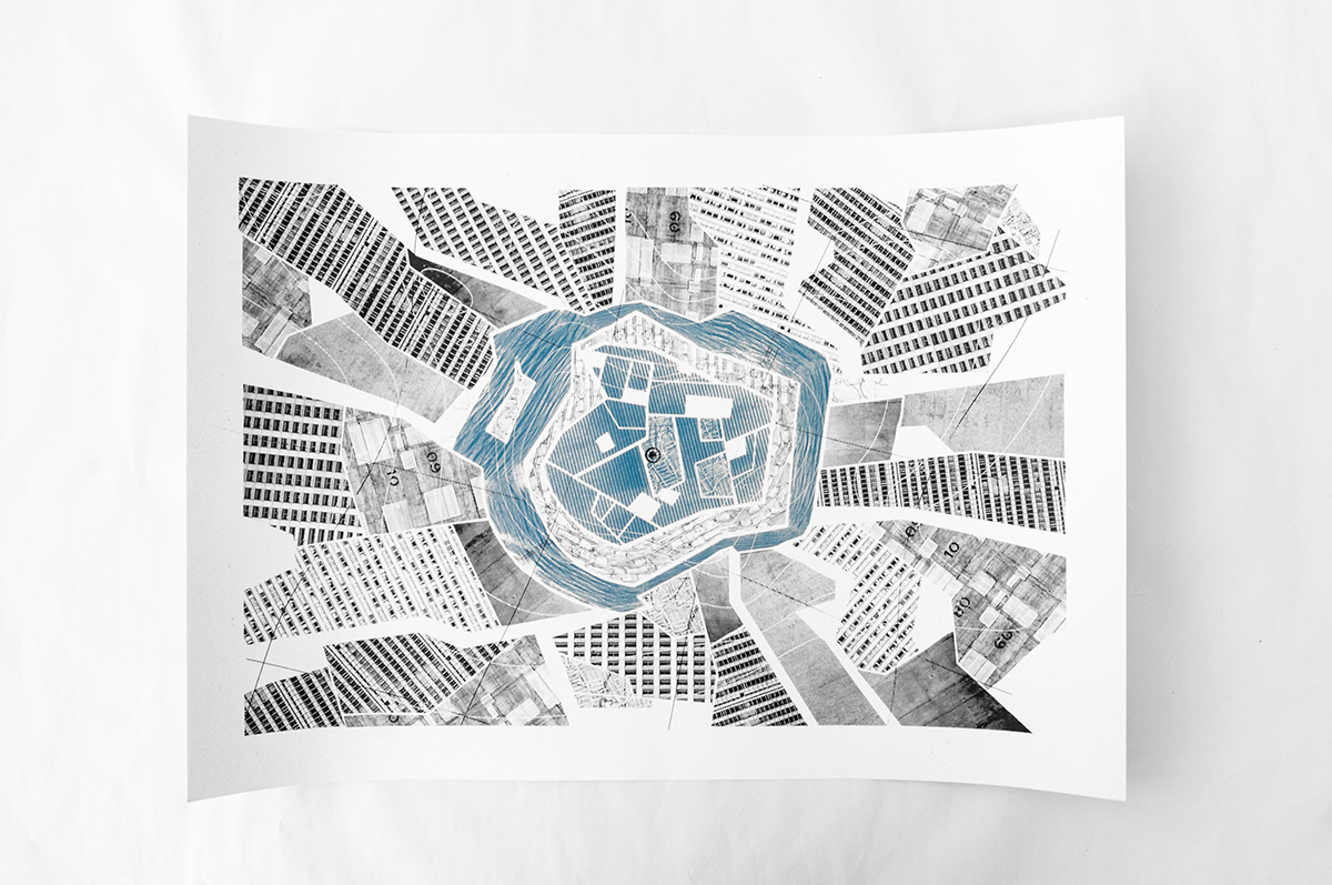
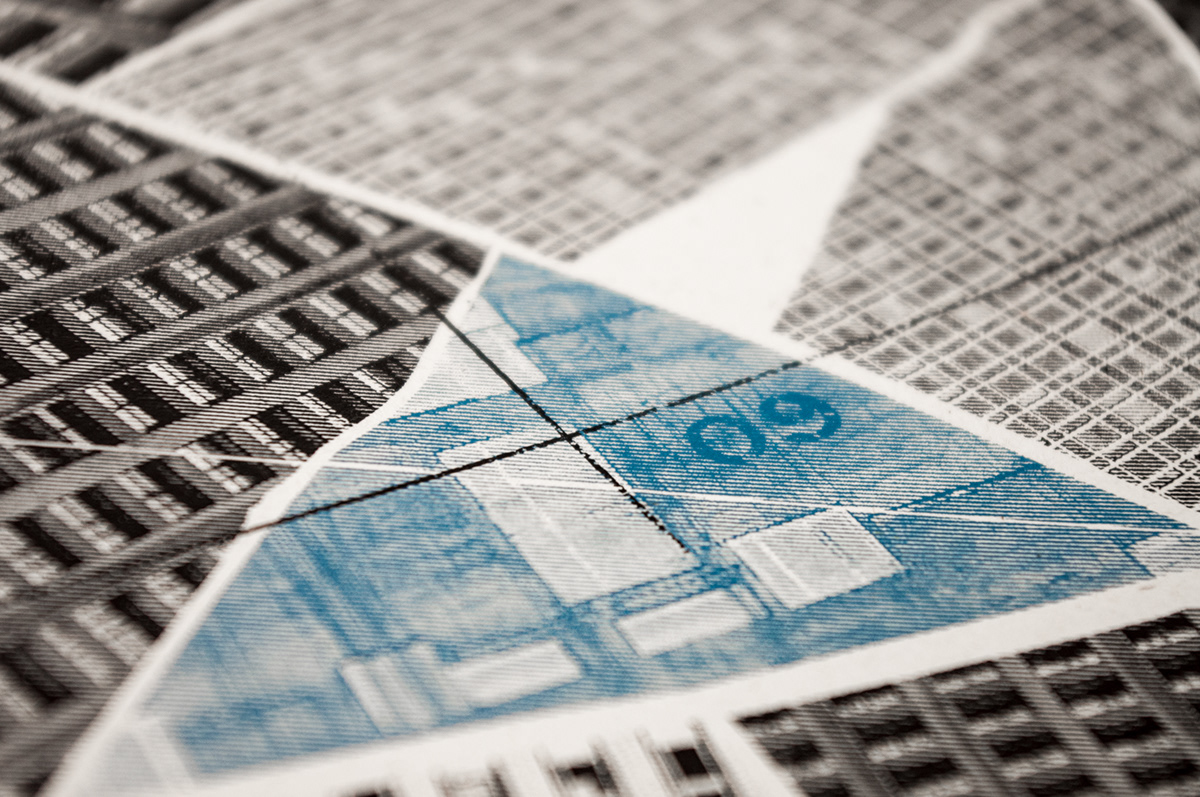
Fortress
2-colour Screen-print
350 × 500 mm
2015
There are several values of the contemporary metropolis that share from dystopian literature. In a direct manner these compositions, as a series of critical maps, aim to form a critique on issues of the modern metropolis. In "Farmlands" urban social housing is being presented as fields. As cities require mass production of goods to maintain population, they also require mass production of population to maintain social, political and economical structures thus question the limit between people and expendability. In the same vain "Fortress" presents an inaccessible city centre, a walled-city, trenched away from the greatest portion of the population but still ample in size in perception. A case not uncommon; metropolises' centres are far from being economically or socially viable to survive or even access and commute through. These inequalities produce the isolation and alienation of the population presented in "Islands" where each area or district is totally detached from each other. The compositions use patterns and textures formed from photographs .
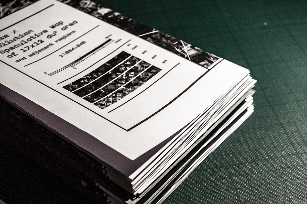
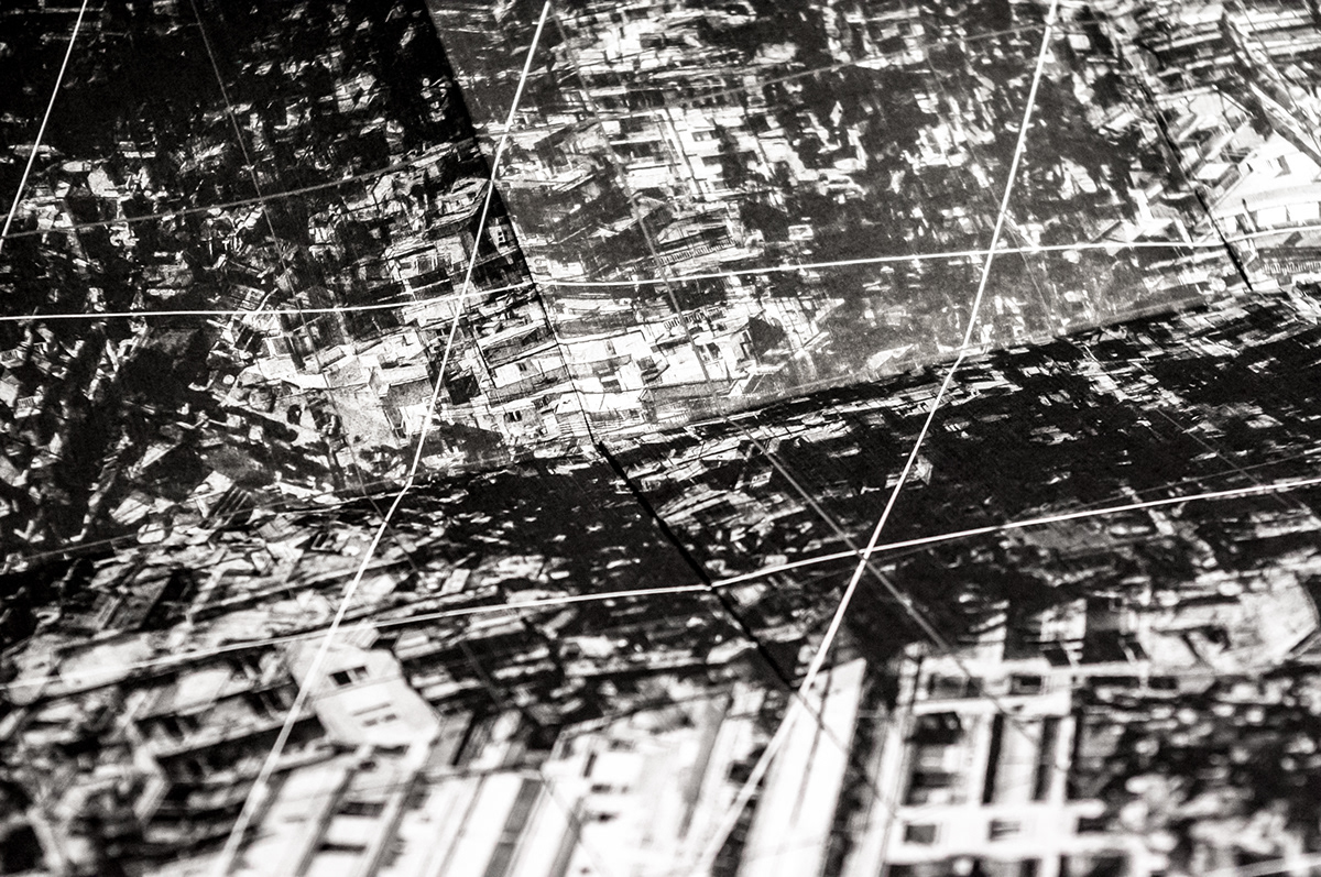
Speculative Maps of XxY Areas
Folded Monochrome Prints
841 × 1189 mm
2015
It is not uncommon to interpret our surroundings solely based on notions or photographic memories and personal experiences of the environment. This interpretations are experienced as a feel—sense, taste—of the landscape whether this urban, social, common or unfamiliar. These maps aim to communicate notions about the urban landscape, the contemporary metropolises. They do not communicate dimensions. Rather they represent problematic situations such as distractive noise pollution, frantically dense population, chaotic and infinite movement. As a form of critical mapping, these maps are created using photos of certain cities (namely London and Athens) but lose their identity in the way as they are multiplied, overlaid and reconstructed into colossal landscapes and huge structures to communicate their message through a notion or feeling as a whole. The maps do use common cartographic visual language. Though it is stripped down, distorted and abstracted to further amplify the message and remain open for the reader's interpretation.
Demapping Metropolises is a series of projects that re-explore the urban landscape. Photographic documentation, as approached by Situationism, provides the basis for an elemental deconstruction of the modern metropolis—a break down to basic forms, shapes, lines and grids, textures and patterns. These structural elements are employed in various visual experiments in an attempt to express situations and relations in the contemporary city. Sharing techniques and concepts from the fields of critical cartography and illustration, the artefacts produced—in form of books, experimental publications, prints, maps and abstract compositions—communicate thoughts and ideas on how the urban environment is perceived non-linearly and non-spatially but based on notions and speculations to eventually compose a critique on socio-political issues of the modern metropolises.