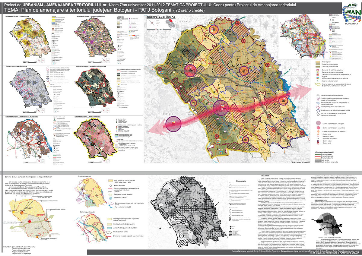
DIAGNOSIS
Located in the northeastern corner of the country, on the border with Ukraine and Moldova, Botosani is the contact area between E.U. and the rest of Eastern Europe. Along the counties of Suceava, Neamt, Bacau, Iasi and Vaslui form the North-Eastern region.
Due to strategic position geographically - pole of European integration at a level that no other county in the north-east it is not, Botosani county has a great potential in terms of development of agricultural activities, economic and transit.Territorial distribution of settlements, mainly in developing along main rivers (Siret, Prut, Jijia,Baseu, Sitna), is uneven in the county, which are concentrated in the west and the north.County's urban system is unstable and the relations between cities and territory are weak. Botosani municipality is the main town and center of the county, polarizing the economic,administrative and cultural.Network is divided into two sub-localities: Dorohoi-Saveni-Darabani-equilibrium potential role in the entire county and Botosani-Bucecea-Flemish-Saveni-Stefanesti which dominates central and south county.
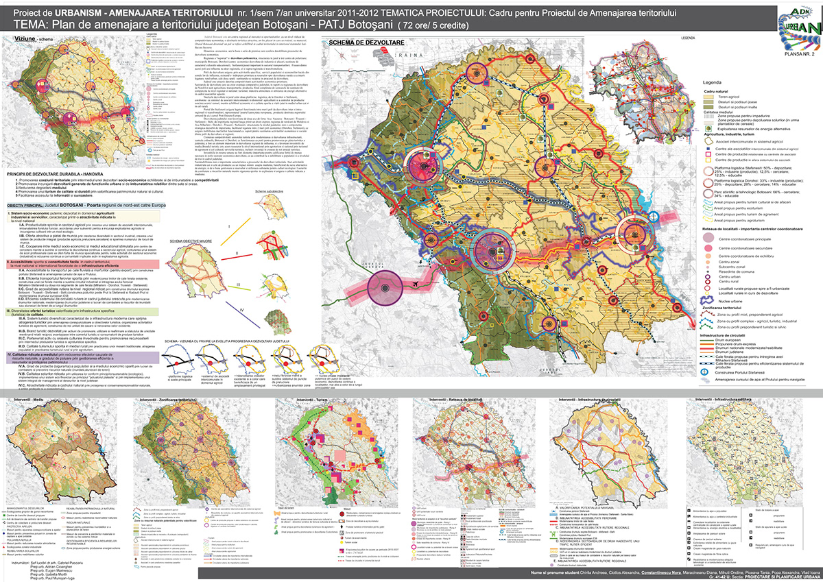
VISION
Botosani is a regional center of innovation and opportunities, with a high level of economic competitiveness, an attractive tourist destination, a nice place to live and work. Botosani city became a center in which restores balance in the system of Iasi, Bacau, Suceava. Economic growth is based on several assumptions that give sustainability of economic development processes. The region has "suffered" a polycentric development, structured around three centers of polarization: Botosani municipality, Dorohoi (developed economic centers of industry and business, supported by cultural and educational), Stefanesti (important point in the transport sector). Each of these poles have influence not only regional but also supra-regional and cross border. Development poles provide specific activities, service population and local economies of their areas of influence, there is a straightening of resources for rural development priority that strengthened rural-urban connection, the two spaces supporting each other in the development process.
The county is attractive due to the economic competitiveness of priority. Cores of the development around the two logistics platforms at Stefanesti and Dorohoi, combined with the inter associations in agriculture and associated manufacturing centers of this branch,maintain economic balance and an improved quality of life. Port of Stefanesti provide functional links between major centers of development and in regional and cross border, representing the "gateway" to the European market, production for export wil lfollow the thread Prut, Danube, Europe.County development is favored by two axes of power:Axis Suceava-Botosani-Trusesti-Stefanesti-Balti, a regional, a road link through the North-East Express from Moldova and Axis Mihaileni-Dorohoi-Trusesti-Stefanesti, structured the county, is a very important strategic component, facilitating connection between two major economic poles (Dorohoi and Stefanesti),which provides mobility support, goods being built to support economic and social activities of the region's development poles.Sustainability is an important characteristic of territorial development process. Both industrial and production activities has a minimal environmental impact, using alternative energy sources and a good management of resources.

