


M Tech Architectural Portfolio
Hello!
I am Johan - thanks for coming here! I'm a freelance graphic designer/3d artist/web designer/stocks trader/furniture builder with a masters degree in Architecture. Been coding in a verity of different languages for the past 12 years, including PHP, HTML, JAVA and PINE. Will design, code or model anything. Worked as lead architectural designer at a medium sized architectural firm for the past two years. The below work was done during my 6 years as an architectural student way back:)
I am Johan - thanks for coming here! I'm a freelance graphic designer/3d artist/web designer/stocks trader/furniture builder with a masters degree in Architecture. Been coding in a verity of different languages for the past 12 years, including PHP, HTML, JAVA and PINE. Will design, code or model anything. Worked as lead architectural designer at a medium sized architectural firm for the past two years. The below work was done during my 6 years as an architectural student way back:)
Shift Subsidized rental accommodation
Poverty and the social elimination of vulnerable population groups are increasing, due to social and political challenges throughout South-Africa. In recent years, the space between income and housing prices has continued to broaden, making housing less affordable. At the same time, South-Africa has seen both a decline in the role of the government in the housing sector and a growing reliance on market forces to satisfy housing demand. Subsequently, the housing needs of the poor and vulnerable are often ineffectually addressed. The availability of affordable housing, however, is crucial for individuals’ well-being and for guaranteeing a socially cohesive society.
The ideal solution would be to provide the whole population with adequately equipped dwellings of suitable size in a well-functioning environment of decent quality at reasonable cost. But in reality the current situation is proving it to be practically impossible, due to high unemployment numbers. The idea behind this development was to create a vibrant mixed use node from where a basic standard of development could derive and infiltrate the city through time. The focus area can be seen as a division between wealthy and poor, thus aiming to reduce the income gap between the two partitions. One of the main generators for choosing the site is the strong link with the perennially flowing Apies River and the existing pedestrian access routes created adjacent it. The centralized nature in regards to the functional necessities such as, schools, shops, churches, clinics, doctors, universities and transport, made the proposed site exceptionally viable. To acquire the necessary density of 100-200 beds per hectare, over the sites 1.1 hectare, a total of more than 300 units can be implemented. The excess space will be used for functions the site can possibly lack; this will include informal trading and small farming areas. Due to the sites elongated nature and continuum of space along the Apies River, provides for a solid basis from where future development can grow from.

Households
The responsibility of tenants/households is principally that of occupants or owners of social housing. Tenants are predominantly consumers of social housing. As in other categories, some of them perform an ownership and management role through cooperatives. Combining the role of tenant with that of owners fosters a sustainable approach to development where ownership entails responsibility for rentable units. By sharing the responsibilities of ownership with a number of tenants, intern increases household income and create a sense of ownership under the residents.
The responsibility of tenants/households is principally that of occupants or owners of social housing. Tenants are predominantly consumers of social housing. As in other categories, some of them perform an ownership and management role through cooperatives. Combining the role of tenant with that of owners fosters a sustainable approach to development where ownership entails responsibility for rentable units. By sharing the responsibilities of ownership with a number of tenants, intern increases household income and create a sense of ownership under the residents.
Work live units
The current unemployment levels are towering and many educated people are suffering thereof. By introducing work trading units on the northern side of the Appies river in axis of the main existing pedestrian paths, will intern give entrepreneurs the tools to sustain themselves and live in the same place. These units can be considered as bachelor housing or for just married couples who wants to cut down on transportation cost.
The current unemployment levels are towering and many educated people are suffering thereof. By introducing work trading units on the northern side of the Appies river in axis of the main existing pedestrian paths, will intern give entrepreneurs the tools to sustain themselves and live in the same place. These units can be considered as bachelor housing or for just married couples who wants to cut down on transportation cost.

Transportation
In terms of transportation the proposed site will link to the existing fabric by introducing a bus system, this system will provide for a daily service between sites all along Spuy street. From Spuy street the busses will be travelling in accordance to a proposed ring road system that allows for the interchange between bus to train rapidly.
Parking area
The notion of a car free city is by no means new, this design incorporates cars to a minimum. The site will be vehicle free intern promoting pedestrianism. To accommodate residents with cars, a parking area is situated towards the south along Volk’s street and will only be a 2 minutes’ walk from the site.

Public square
In this proposal the introduced public square can be considered as the social hart. The Appies river forms a malleable edge and establishes a defined boundary between nature and manmade structures. In terms of axial arrangements the public square is positioned in such a manner to create a visual link with Volks street and in return create a sense of interest to outsiders. The square acts as part of a gateway to different functional activities such as transportation and trading. In terms of circulation the square is situated in direct path of existing pedestrian traffic routes and forms a link between east to south.
In this proposal the introduced public square can be considered as the social hart. The Appies river forms a malleable edge and establishes a defined boundary between nature and manmade structures. In terms of axial arrangements the public square is positioned in such a manner to create a visual link with Volks street and in return create a sense of interest to outsiders. The square acts as part of a gateway to different functional activities such as transportation and trading. In terms of circulation the square is situated in direct path of existing pedestrian traffic routes and forms a link between east to south.
FADING THE DIVIDE An information based community development center
A general stigma surrounding information technologies in low-income communities is seen as common. This is due to the perception that by gaining knowledge through technology will not satisfy their immediate needs. In order to create a general acceptance and appreciation, the progression of civic learning facilities should be culturally influenced and contextually manifested within the immediate community.
This project explored ways in which to aid in the process of community development and social reconstruction through an architectural intervention based within an informal setting. The proposal aimed to better the community of Mandela Village, by providing a multi functional learning facility, which fully integrates itself into the existing monetary and social fabric of Mamelodi. Main objectives includes; an obtainable architectural solution with positive long term outcomes, which could aid in uplifting the current living conditions the immediate society is faced with. The design aimed to provide for a sensible yet sustainable approach, which could educate and transform the current situation regarding building typology in shack towns.

Conceptually the intent was to creating a multi-purpose landmark of learning and teaching through information based technology, in order to uplift the community of Mamelodi. This concept provides for the overall framework from where to close the existing gap between developed and informal communities, thus "fading the divide".


Vertical Horizons
The rise of the skyscraper was not driven by programmatic needs or artistic desires, but rather economic conditions coupled with turn-of-the-century technological innovations. As it evolved, systems matured to provide comfort and safety while economic efficiency was always prioritized. The skyscraper and its systems reached its evolutionary plateau in the 1950s when mechanized systems transformed the building type into air-tight homogenous structures, maximizing efficiency and economy. This was based on an office culture that today, due to innovations in communications technology, is growing ever more obsolete. However, as cities continue to grow, skyscrapers are increasingly residential. In fact, residential skyscrapers can have population and land areas similar to city neighborhoods, yet lack any character or identities that give neighborhoods diversity.
The rise of the skyscraper was not driven by programmatic needs or artistic desires, but rather economic conditions coupled with turn-of-the-century technological innovations. As it evolved, systems matured to provide comfort and safety while economic efficiency was always prioritized. The skyscraper and its systems reached its evolutionary plateau in the 1950s when mechanized systems transformed the building type into air-tight homogenous structures, maximizing efficiency and economy. This was based on an office culture that today, due to innovations in communications technology, is growing ever more obsolete. However, as cities continue to grow, skyscrapers are increasingly residential. In fact, residential skyscrapers can have population and land areas similar to city neighborhoods, yet lack any character or identities that give neighborhoods diversity.


Urban connectivity
In the sense of connecting people it is vital to have sufficient transportation, the site location provides for an short distance link to Pretoria station. With the new Buss Rapid Transport system soon to be implemented, this form part of the functionality of the station and help to promote the notion of an vehicle free city.
In the sense of connecting people it is vital to have sufficient transportation, the site location provides for an short distance link to Pretoria station. With the new Buss Rapid Transport system soon to be implemented, this form part of the functionality of the station and help to promote the notion of an vehicle free city.

This project reconceived the skyscraper as a vertical neighbourhood - a dynamic network of communities in the sky. The inverted design process prioritized the community by focusing upon the internal social and spatial systems of the skyscraper. The influence of this prioritization also redefined the currently parasitic relationship of the skyscraper to the city into a symbiotic one: the living skyscraper becomes part of an urban food chain, dependent on the environment to insure its own survival, and on the city to provide identity and culture. The design exploration thoughtfully integrates systems as a result of a social agenda, creating a dialogue that raises questions and aspirations about the social validity and potential of the skyscraper as it exists today. Built-up Neighbours, included design measures and community spaces built into a high-rise high-density apartment building to encourage the formation of a genuine neighbourhood and diverse communities.
FRAME A film, media and dramatic arts school
South Africa's film and television industry is currently regarded as the biggest contributor to economic growth within the entertainment sector. Evidencing extraordinary growth, the industry has developed a dire need for professionals in the various fields of acting, film production, broadcasting and directing. In response, this project aims to assist in the amelioration thereof. It seeks to rethinks the role and functioning of the physical education campus in our current "Interactional Age" and intend to include the surrounding community within the learning envelope. The focus area comprises possibilities of urban integration into existing frameworks such as the Nelson Mandela Development Corridor (MDC) and the Re Kgabisa Tshwane transportation strategy. Furthermore this project propose the implementation of a pedestrianized arts and cultural boulevard, in an effort to revitalize the current degraded and highly fragmented sidewalk culture which exists in the area between Bloed Street Taxi Mall and the selected site. The site locality was of utmost importance within this project, as vicinity in this instance could very well determine project success. The proposed locality offered various catalytic surrounding functions, such as dining establishments, sport facilities and an already established student environment generated by the TUT Arts campus. The site locality within its context furthermore presented an opportunity to uplift the degraded Apies River by utilizing the qualities of water when implemented adjacent architectural form.
South Africa's film and television industry is currently regarded as the biggest contributor to economic growth within the entertainment sector. Evidencing extraordinary growth, the industry has developed a dire need for professionals in the various fields of acting, film production, broadcasting and directing. In response, this project aims to assist in the amelioration thereof. It seeks to rethinks the role and functioning of the physical education campus in our current "Interactional Age" and intend to include the surrounding community within the learning envelope. The focus area comprises possibilities of urban integration into existing frameworks such as the Nelson Mandela Development Corridor (MDC) and the Re Kgabisa Tshwane transportation strategy. Furthermore this project propose the implementation of a pedestrianized arts and cultural boulevard, in an effort to revitalize the current degraded and highly fragmented sidewalk culture which exists in the area between Bloed Street Taxi Mall and the selected site. The site locality was of utmost importance within this project, as vicinity in this instance could very well determine project success. The proposed locality offered various catalytic surrounding functions, such as dining establishments, sport facilities and an already established student environment generated by the TUT Arts campus. The site locality within its context furthermore presented an opportunity to uplift the degraded Apies River by utilizing the qualities of water when implemented adjacent architectural form.
The conceptualization process was focused on locating parallels between architecture and film, these findings contributed greatly in the event of establishing a suitable building typology. Two local film institutions were visited and analyzed, which formed the basis from which the proposed school's function and functional requirements originated. Ultimately, this project aims to alter the current mono-functional nature of today's physical campus by promoting cultural and social pa


Nelson Mandela Corridor (MDC), 2009
The Nelson Mandela Redevelopment Corridor (MDC) constitutes a divisional part of the projected Re Kgabisa Tshwane framework, aimed at the urban regeneration of the area alongside Nelson Mandela Drive, which runs from Muckleneuk to Arcadia. The initiative was first proposed by Holm-Jordaan in 2001 (Holm, 2001). Since then many architects’ firms and urban designers have worked on producing sensible solutions for how to implement such a renewal strategy in the city of Tshwane. Ludwig Hansen Architects and Urban Designers suggested a spatial principle to define public realms within the areas wedged between Pretoria’s CBD and its densely populated residential suburbs such as Sunnyside and Arcadia. The proposed framework was further developed by Encha Properties and was approved by the Department of Regional Services in 2009. The initiative included revitalisation strategies which are intended to improve public transport and urban management programmes. The development of the corridor is designed to create a capital turnover of more than R1, 7 billion per year and create 9000 job opportunities (MDC council approval, 2009). The adjacent image illustrates the proposed development corridors within the spatial development intuitive. Each corridor is made up of various nodes of functions. Currently the Nelson Mandela Redevelopment Corridor consists of an automotive, sports, heritage and a business node. The intention of this thesis is to integrate the new facility together with the TUT Arts Campus into the Nelson Mandela redevelopment corridor (blue strip). The artistic nature of the two schools, their locality and close proximity to each other, could form the backbone on which an arts and cultural exchange point could be established. The integration of the two artistic entities provided for the prospect of creating an arts and cultural boulevard from the new proposed establishment all the way north to Bloed Street taxi rank (red dotted line).
The Nelson Mandela Redevelopment Corridor (MDC) constitutes a divisional part of the projected Re Kgabisa Tshwane framework, aimed at the urban regeneration of the area alongside Nelson Mandela Drive, which runs from Muckleneuk to Arcadia. The initiative was first proposed by Holm-Jordaan in 2001 (Holm, 2001). Since then many architects’ firms and urban designers have worked on producing sensible solutions for how to implement such a renewal strategy in the city of Tshwane. Ludwig Hansen Architects and Urban Designers suggested a spatial principle to define public realms within the areas wedged between Pretoria’s CBD and its densely populated residential suburbs such as Sunnyside and Arcadia. The proposed framework was further developed by Encha Properties and was approved by the Department of Regional Services in 2009. The initiative included revitalisation strategies which are intended to improve public transport and urban management programmes. The development of the corridor is designed to create a capital turnover of more than R1, 7 billion per year and create 9000 job opportunities (MDC council approval, 2009). The adjacent image illustrates the proposed development corridors within the spatial development intuitive. Each corridor is made up of various nodes of functions. Currently the Nelson Mandela Redevelopment Corridor consists of an automotive, sports, heritage and a business node. The intention of this thesis is to integrate the new facility together with the TUT Arts Campus into the Nelson Mandela redevelopment corridor (blue strip). The artistic nature of the two schools, their locality and close proximity to each other, could form the backbone on which an arts and cultural exchange point could be established. The integration of the two artistic entities provided for the prospect of creating an arts and cultural boulevard from the new proposed establishment all the way north to Bloed Street taxi rank (red dotted line).

Public transportation
The Re Kgabisa Tshwane’s vision concept encompasses regenerative frameworks which include various entities surrounding urban liveliness. Its scope incorporates both public and private transportation enhancement networks, which are chiefly focused on the ease of access and availability of transportation resources within Pretoria’s main business districts. The above image illustrates the proposed public transportation bus routes (grey), the locality of major interchange points (red) and common bus stops (green) which the Department of Public Works (DPW) and the Department of Public Service and Administration (DPSA) project to be active by 2016. The intended transportation network is set to unify the city’s inner functions and provide for an interconnected grid formation, which will be linked to the Gautrain station and Pretoria central to the south (http://www.rekgabisatshwane.gov. za/images/precincts/main_Public-Tran.jpg).
The Re Kgabisa Tshwane’s vision concept encompasses regenerative frameworks which include various entities surrounding urban liveliness. Its scope incorporates both public and private transportation enhancement networks, which are chiefly focused on the ease of access and availability of transportation resources within Pretoria’s main business districts. The above image illustrates the proposed public transportation bus routes (grey), the locality of major interchange points (red) and common bus stops (green) which the Department of Public Works (DPW) and the Department of Public Service and Administration (DPSA) project to be active by 2016. The intended transportation network is set to unify the city’s inner functions and provide for an interconnected grid formation, which will be linked to the Gautrain station and Pretoria central to the south (http://www.rekgabisatshwane.gov. za/images/precincts/main_Public-Tran.jpg).
This project also aims to promote the use of public transportation by proposing to integrate the intended facility within the Re Kgabisa regenerative framework. From the adjacent image, it can be seen that the already established Nelson Mandela Drive bus route, is intended to border the selected design site (western edge) and that the proposals by the Department of Public Works (DPW) include two bus stops within close proximity to the site. This project proposes to relocate the proposed bus stop which is currently located on the corner of Proes Street and Nelson Mandela Drive on the selected site. This relocation should in turn load to intensified pedestrian activity on site and entice facility users to utilize public transportation methods.

Concept
The architectural envelope should seek to mediate the overlapping realms which exist between film and architecture. It ought to translate the relationship between vision, movement and sequenced time into form and space ultimately sculpting a framework from which architecture can connect, interact and communicate to its users. The highly influential text of Jean Nouvel (2002:27), was found to translate the conceptual meaning and objectives of this design best, when he stated: “Architecture exists, like cinema, in the dimensions of time and movement. One conceives and reads a building in terms of sequences. To erect a building is to predict and seek effects of contrast and linkage through which one passes... In the continuous shot of sequence that a building is, the architect works with cuts and edits, framings and openings”.
The architectural envelope should seek to mediate the overlapping realms which exist between film and architecture. It ought to translate the relationship between vision, movement and sequenced time into form and space ultimately sculpting a framework from which architecture can connect, interact and communicate to its users. The highly influential text of Jean Nouvel (2002:27), was found to translate the conceptual meaning and objectives of this design best, when he stated: “Architecture exists, like cinema, in the dimensions of time and movement. One conceives and reads a building in terms of sequences. To erect a building is to predict and seek effects of contrast and linkage through which one passes... In the continuous shot of sequence that a building is, the architect works with cuts and edits, framings and openings”.


Pre-established outcomes
The design of a film, media and dramatic arts school should aim to shift the current passive mono-functional relationship between society and its learning environments, into an active engagement of everyone. This effort must be communally driven, promoting awareness whilst injecting interest throughout the neighborhood of Arcadia. The program ought to be of a
dynamic nature, which expresses its place in time and in return seeks to create an amplified standard for educational scheme in South Africa. Public functions should be included as part of an active participation system from which the community can feel connected. The architectural structures created must appeal to everyone, with spatial environments designed to promote cultural exchange.
The building envelope should be a translated extension of its artistic inner function and aim to establish a synthesis between its function and architectural form. The spatial environment both internally and externally must aspire to reflect a high level of technology, whilst still regarding its place in context and history. The new facility should engage with the immediate public, both vehicular and pedestrian, and endeavor to revitalize its surrounding street edges. Furthermore, the overall design must seek ways in which to seamlessly integrate itself within an existing urban framework, enhancing the current social fabric. It must therefore be in close proximity to catalytic functions, such as dining establishments, sports venues, housing and cultural activities. The locality should be easily accessible and must promote public transportation.
A high level of dynamics should be reflected through structure and materials, seeking ways in which to utilize building components as knowledge distributers. The structure must be of an extremely high standard and should aim to supply users with quality activities, be these in play, business, leisure or teaching. Ultimately, the proposed intervention must seek to establish itself as a local benchmark for educational facilities and display an international standard in its agenda, as well as in structure.

Vertical circulation
This includes elements such as stairs lifts and ramps; these structures link floor levels with one another and are therefore planned to promote security where needed. The use of ramps is prioritized, since these structures allow for active visible movement within and outside the building whilst furthermore facilitating movement for the disabled. Fire escapes, service elevators and service ducts form part of the main vertical access cores within the structure, and will be grouped where possible in order to minimize space and materials.
This includes elements such as stairs lifts and ramps; these structures link floor levels with one another and are therefore planned to promote security where needed. The use of ramps is prioritized, since these structures allow for active visible movement within and outside the building whilst furthermore facilitating movement for the disabled. Fire escapes, service elevators and service ducts form part of the main vertical access cores within the structure, and will be grouped where possible in order to minimize space and materials.

Grouping
The general student studios must be grouped and easily accessible to one another in order to promote peer interaction. They will be located in such a manner as to express internal accomplishments between different academic years. All administrative functions will be located together in order to encourage communication and the transfer of information. The intended public functions are to include a media library and media resource centre, which will function best if, grouped, for they could then operate as a single coherent element which could share a single reception area and thereby minimise security requirements.
The general student studios must be grouped and easily accessible to one another in order to promote peer interaction. They will be located in such a manner as to express internal accomplishments between different academic years. All administrative functions will be located together in order to encourage communication and the transfer of information. The intended public functions are to include a media library and media resource centre, which will function best if, grouped, for they could then operate as a single coherent element which could share a single reception area and thereby minimise security requirements.

Horizontal circulation
The majority of functional spaces within the proposed envelope (educational and administrative sections) will be facing north in order to reduce energy consumption; thus leaving the southern edges open for circulation space which will in turn, allow for visual movement to be visible from the proposed gathering space located in the center of the two previously established masses. Although the proposed configuration consists of two separate functional masses (auditorium and educational), the need to join them together proved viable, as the auditorium will be mostly used for educational purposes. The linking of these two spaces will be assisted by a covered walkway, raised to allow movement through the site.
The majority of functional spaces within the proposed envelope (educational and administrative sections) will be facing north in order to reduce energy consumption; thus leaving the southern edges open for circulation space which will in turn, allow for visual movement to be visible from the proposed gathering space located in the center of the two previously established masses. Although the proposed configuration consists of two separate functional masses (auditorium and educational), the need to join them together proved viable, as the auditorium will be mostly used for educational purposes. The linking of these two spaces will be assisted by a covered walkway, raised to allow movement through the site.

The Apies River
Ever since the Apies River was channelled in 1935, it has steadily been downgrading, losing its vibrancy over time. Today, the artery is regarded as lifeless, a concrete storm water channel which does not add to any type of urban vitality. It is in most cases unmaintained and has gained a reputation amongst its users as grimy and polluted (Loots, 2007:10-11). However, our current era calls for a re-evaluation of the old and forgotten, an all encompassing consideration of what is needed to reactivate the current situation. The prospect of aiding in uplifting Pretoria’s main natural resource consist not only of the vitality of enhancing the river’s existence, but also an understanding of what exactly it could contribute to. The river flows for more than 9km through the city. This stretch is in most areas, bordered by open space on either side, which can currently be referred to as lost space. These areas could cater for the active recreational needs of Pretoria’s residents, providing areas which may be converted to facilitate socialising, cycling, dining and walking. These spaces could become the playrooms of our urban environment, the life spine of our city. Not only are these spaces vacant and ready for change, they are also continued throughout the city and could act as a social connecting element. Furthermore, the Apies River shifts approximately 60 million litres of natural spring water daily through our main business district; this amount of constantly fl owing water could contribute greatly to the vibrancy of our city interiors if utilised correctly (http://www.ewisa.co.za/misc/RiverGAUApies.html).
Ever since the Apies River was channelled in 1935, it has steadily been downgrading, losing its vibrancy over time. Today, the artery is regarded as lifeless, a concrete storm water channel which does not add to any type of urban vitality. It is in most cases unmaintained and has gained a reputation amongst its users as grimy and polluted (Loots, 2007:10-11). However, our current era calls for a re-evaluation of the old and forgotten, an all encompassing consideration of what is needed to reactivate the current situation. The prospect of aiding in uplifting Pretoria’s main natural resource consist not only of the vitality of enhancing the river’s existence, but also an understanding of what exactly it could contribute to. The river flows for more than 9km through the city. This stretch is in most areas, bordered by open space on either side, which can currently be referred to as lost space. These areas could cater for the active recreational needs of Pretoria’s residents, providing areas which may be converted to facilitate socialising, cycling, dining and walking. These spaces could become the playrooms of our urban environment, the life spine of our city. Not only are these spaces vacant and ready for change, they are also continued throughout the city and could act as a social connecting element. Furthermore, the Apies River shifts approximately 60 million litres of natural spring water daily through our main business district; this amount of constantly fl owing water could contribute greatly to the vibrancy of our city interiors if utilised correctly (http://www.ewisa.co.za/misc/RiverGAUApies.html).

Riemvasmaak Desert lodge and tourist research centre
Riemvasmaak is a isolated area about 56 kilometres from Kakamas adjoining the Orange River to the South, Namibia to the West. Current unemployment borders on 99% in the region. The present eco-tourism projects in Riemvasmaak provides for employment to the minority of its community members during off-peak periods, adding up to about 34 people out of a 1 000 residents. Throughout the crest tourist period, April to September, the employment levels doubles providing jobs for up to 80 casual workers, including a small number of field guides on a regular basis. The new desert lodge and research tourism centre will provide for approximately 35 job opportunities as permanent staff and also generate jobs during the construction period.
Riemvasmaak is a isolated area about 56 kilometres from Kakamas adjoining the Orange River to the South, Namibia to the West. Current unemployment borders on 99% in the region. The present eco-tourism projects in Riemvasmaak provides for employment to the minority of its community members during off-peak periods, adding up to about 34 people out of a 1 000 residents. Throughout the crest tourist period, April to September, the employment levels doubles providing jobs for up to 80 casual workers, including a small number of field guides on a regular basis. The new desert lodge and research tourism centre will provide for approximately 35 job opportunities as permanent staff and also generate jobs during the construction period.

Materials
The local surroundings inspire the use of similar building materials. This insures that the building protrudes from the site, and the site forms part of the building. The proposed local materials used imitate nature's textures and colours. Physical elements like rock, soil, sand, vegetation and timber all form part of the visual picture of the sites landscape. These elements form the foundation of inspiration when designing. Instead of rejecting the harsh elements of the dessert, one must accept and embrace them. By using this to your advantage when designing in the dessert, one enhances the overall effect of the design. The harsh elements insure natural change of elements and materials, a process that humans seem to reject more and more. The corrosion of metal would look out of place in a lush green environment, but when placed in the dessert it emphasizes vulnerability under the harsh desert sun. The desert turns the metal of a tin can into a rusty lace reminiscent of an autumn leaf. Rammed earth excavated from the site is used to construct the majority of the walls. Timber is used for furniture and support beams. Timber ads history and warmth to the design. The aim of the design is to have a local taste. Instead of buildings discarding its environment, it ads and adapts to its surroundings.
The local surroundings inspire the use of similar building materials. This insures that the building protrudes from the site, and the site forms part of the building. The proposed local materials used imitate nature's textures and colours. Physical elements like rock, soil, sand, vegetation and timber all form part of the visual picture of the sites landscape. These elements form the foundation of inspiration when designing. Instead of rejecting the harsh elements of the dessert, one must accept and embrace them. By using this to your advantage when designing in the dessert, one enhances the overall effect of the design. The harsh elements insure natural change of elements and materials, a process that humans seem to reject more and more. The corrosion of metal would look out of place in a lush green environment, but when placed in the dessert it emphasizes vulnerability under the harsh desert sun. The desert turns the metal of a tin can into a rusty lace reminiscent of an autumn leaf. Rammed earth excavated from the site is used to construct the majority of the walls. Timber is used for furniture and support beams. Timber ads history and warmth to the design. The aim of the design is to have a local taste. Instead of buildings discarding its environment, it ads and adapts to its surroundings.

Locality
The site is located in the Northern Cape neighboring the Augrabies Falls National Park. The site has a gradual slope down, towards the East connecting to the river. A series of sheer rocky hills is situated to the West, and will provide for some refuge from the harsh afternoon sun. The proposed structure is all single stories and highlights the meticulous horizontality of the region. The main approach to the site is highlighted by a sequence of rocky hills located to the North given that it forms a natural access point and is well suited for the reception which connects to the Airport. The lodge flows seamlessly from this point, permitting for an arrangement which assist the living units to have an isolated position with inimitable views of the desert terrain and Orange River gorge.
The site is located in the Northern Cape neighboring the Augrabies Falls National Park. The site has a gradual slope down, towards the East connecting to the river. A series of sheer rocky hills is situated to the West, and will provide for some refuge from the harsh afternoon sun. The proposed structure is all single stories and highlights the meticulous horizontality of the region. The main approach to the site is highlighted by a sequence of rocky hills located to the North given that it forms a natural access point and is well suited for the reception which connects to the Airport. The lodge flows seamlessly from this point, permitting for an arrangement which assist the living units to have an isolated position with inimitable views of the desert terrain and Orange River gorge.

Reception
The building lives out to the south, into a semi enclosed space. Interior comfort levels will be controlled by an evaporative cooling device and solar chimneys. The building connects to the airport via gravel road and consists of a parking area on the southern side and will be where guests will leave their vehicles; from this point on, the lodge will be vehicle free with exception to staff.
Airport .
The airport consists of a 65m² concrete roof which covers a waiting area, small storage space and a toilet. Communication between the arriving aircraft and reception will be made possible via radio. This will ensure that guests will be collected soon after arrival. A small runway will be located next to the structure. The airport will be linked to the reception via gravel road.

Single living units
The eight 110m² open plan single living units each consists of a bathroom with indoor and outdoor shower, bedroom and a small reading lounge which flows out into the open landscape to the south and establishes a seamless connection between structure and terrain. A covered patio binds the unit with the swimming pool and open patio. These units connect to the rest of the lodge by means of pathways and will be accessible to cleaning staff via gravel road.
The eight 110m² open plan single living units each consists of a bathroom with indoor and outdoor shower, bedroom and a small reading lounge which flows out into the open landscape to the south and establishes a seamless connection between structure and terrain. A covered patio binds the unit with the swimming pool and open patio. These units connect to the rest of the lodge by means of pathways and will be accessible to cleaning staff via gravel road.
Restaurant and bar
The 195m Restaurant consists of an reception with an small office, open plan seating area for 24 people, connecting to a bar area. A small kitchen flows out to a open traditional food preparation area where delicacies unique to this area can be prepared on a open fire, like“puff adders” (named after the snake) and “skilpadje” (tortoise).Ablutions is located adjacent to the restaurant. The structure is approached from the West following a walkway leading towards the reception. The restaurant is based on an open plan arrangement, opening towards the South. A delivery and waste removal area is located on the Western side of the building and connects to the staff quarters via gravel road
The 195m Restaurant consists of an reception with an small office, open plan seating area for 24 people, connecting to a bar area. A small kitchen flows out to a open traditional food preparation area where delicacies unique to this area can be prepared on a open fire, like“puff adders” (named after the snake) and “skilpadje” (tortoise).Ablutions is located adjacent to the restaurant. The structure is approached from the West following a walkway leading towards the reception. The restaurant is based on an open plan arrangement, opening towards the South. A delivery and waste removal area is located on the Western side of the building and connects to the staff quarters via gravel road

Viewing station
The viewing station is located on the Orange rivers edge and allows visitors to experience the true contrast between the very dry landscape at ground floor with wide open views of the desert and the raging river at basement level. The building is connected to the rest of the lodge by pathways and will be accessible to maintenance staff via gravel road.
Family units
The units flow out into the landscape and establish a bond between visitor and terrain. The main bedroom ties with landscape by a private patio. A small reading lounge connects to the open swimming pool through a covered patio. A shared bedroom connects to a bathroom. The units join to the rest of the lodge through pathways and will be accessible to cleaning staff via gravel road.
ZERO2110 Caesarstone
Brief
The setting is 2110 and Zertron Energy Rehabilitation Orbital's have redefined the human transportation industry. The new brain of international innovation and fashion now unquestionably resides in Soweto, South Africa, the most expensive real estate on the globe. Rebuild over the past 90 years Soweto bears no resemblance of a bygone era. Now home of the International Zeroport, African Government and the HQ of ZERO manufacturing. To mark the launch of the new era, ZERO has commission architects and interior designers to design a new conference and exhibition Space which will be suspended between the three CES towers 500 meters above ground level.


Pavilion An impending world cup.
HM Pitje Stadium is a multi-purpose stadium located in Mamelodi, Tshwane. Prior to 2010, FIFA selected a number of potential training stadiums for their world class soccer event, including HM Pitje Stadium. The stadium necessitated in all their needs regarding locality and size, but required a major renovation in order to receive their final approval. In order to meet FIFA standards, the focus was set on redesigning the main pavilion to accommodate more spectators. This project was solitarily focused on developing the western wing of the stadium into a structurally sound configuration which could accommodate an additional 1500 commuters.
HM Pitje Stadium is a multi-purpose stadium located in Mamelodi, Tshwane. Prior to 2010, FIFA selected a number of potential training stadiums for their world class soccer event, including HM Pitje Stadium. The stadium necessitated in all their needs regarding locality and size, but required a major renovation in order to receive their final approval. In order to meet FIFA standards, the focus was set on redesigning the main pavilion to accommodate more spectators. This project was solitarily focused on developing the western wing of the stadium into a structurally sound configuration which could accommodate an additional 1500 commuters.


New S.A.P. headquarters
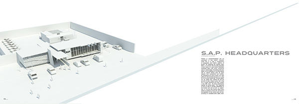
Pretoria is compartmentalised into an assortment of very distinct character areas. This is in part a consequence of topography and historic patterns of growth. By inspecting the existing urban fabric, it is obvious that the area proposed consist mainly of a semi-dense dilapidated residential fabric, with some commercial parts on street edges. The setting of the new station will be essential to its performance due to various factors such as quick dispatch time, accessibility and visibility. By addressing the above issues, the ideal setting for the proposed structure is in Luttig Str. on a current vacant site. The new station will be visible from Rebeca Str. and will provide for easy dispatch given that Luttig Str. is mostly residential and intern creates a low traffic zone. All police departments operate via zoning areas. The magnitude of such an area is normally established by the location and size of such a station. Due to the fact that Pretoria West Police Station is situated in Church Str. will result in the separation of the current zone into two, providing an increased public safety level.
Pretoria is compartmentalised into an assortment of very distinct character areas. This is in part a consequence of topography and historic patterns of growth. By inspecting the existing urban fabric, it is obvious that the area proposed consist mainly of a semi-dense dilapidated residential fabric, with some commercial parts on street edges. The setting of the new station will be essential to its performance due to various factors such as quick dispatch time, accessibility and visibility. By addressing the above issues, the ideal setting for the proposed structure is in Luttig Str. on a current vacant site. The new station will be visible from Rebeca Str. and will provide for easy dispatch given that Luttig Str. is mostly residential and intern creates a low traffic zone. All police departments operate via zoning areas. The magnitude of such an area is normally established by the location and size of such a station. Due to the fact that Pretoria West Police Station is situated in Church Str. will result in the separation of the current zone into two, providing an increased public safety level.
Conceptual objectives
The ongoing effort to characterise the South Africans Police Service (SAPS) as a facility that can ensure public safety and provide high-quality service to the community, has proven to be a far-reaching challenge; especially in low-income areas ever since the 1994 election. Prior to the voting, the organization was known as the South African Police (SAP) and was regarded as a force designed to have utmost control regarding decision making responsibilities of the country. Recent dispensation made it mandatory to deliver a service, to be open and approachable to the public. By examining the existing SAPS facilities, the above does not correlate with the present situation, for all Police stations constructed before 1994 were designed to exclude the public by being perceived as fortress like buildings. Modern day architecture should reject this aged concept and focus on public participation and communication by providing inviting, well designed functional spaces.
The ongoing effort to characterise the South Africans Police Service (SAPS) as a facility that can ensure public safety and provide high-quality service to the community, has proven to be a far-reaching challenge; especially in low-income areas ever since the 1994 election. Prior to the voting, the organization was known as the South African Police (SAP) and was regarded as a force designed to have utmost control regarding decision making responsibilities of the country. Recent dispensation made it mandatory to deliver a service, to be open and approachable to the public. By examining the existing SAPS facilities, the above does not correlate with the present situation, for all Police stations constructed before 1994 were designed to exclude the public by being perceived as fortress like buildings. Modern day architecture should reject this aged concept and focus on public participation and communication by providing inviting, well designed functional spaces.
The relationship between architecture and its surroundings is a recurrent issue since architecture in its broadest sense consist of indoor and outdoor space. Modern day architecture should be structured around the connection of the two spaces, in turn creating ordered and functional spaces. In the proposed the transition between indoors and outside is created by a series of visible lines of sight. The building's entrance flows seamlessly into public domain and provides for a visual connection from the street. The main objective was to oppose the current fortification of police stations by create an open and inviting connection.


