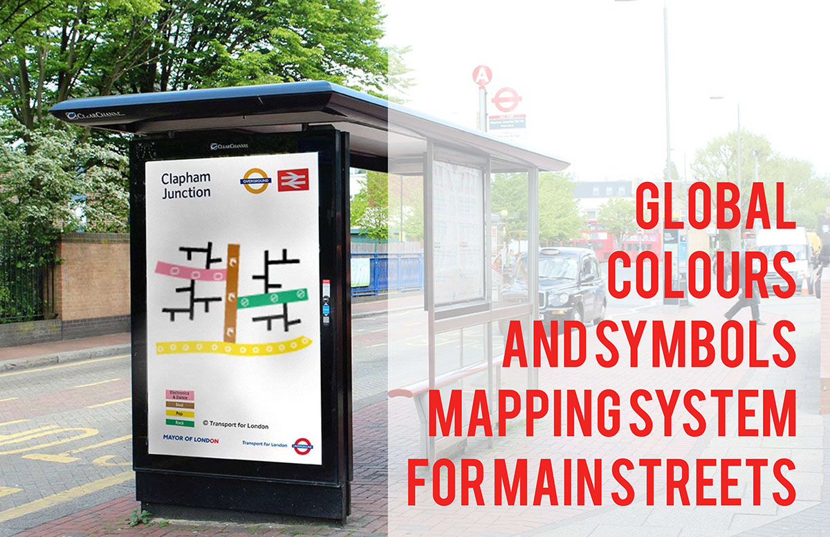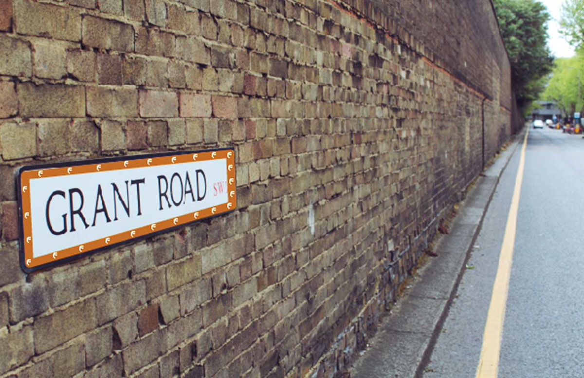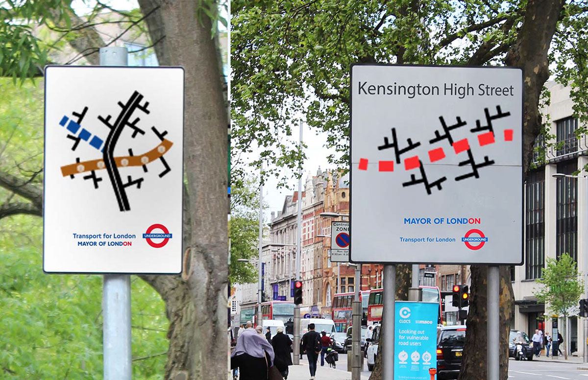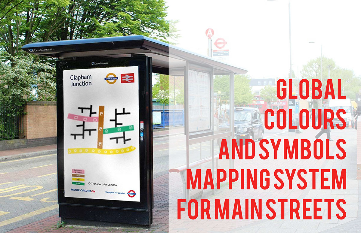
CONCEPT: A global color and symbol system for main streets. The system would work as a part of a global system, but symbols and colors would be culture-specific. Inspired by global tube and subway maps, this signage would act as a supplement to any current street-name-signage system being used in the city.
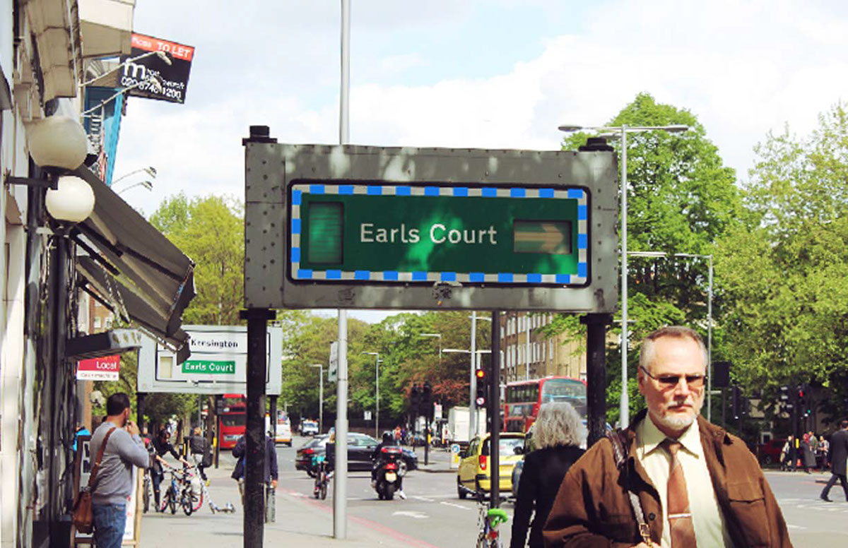
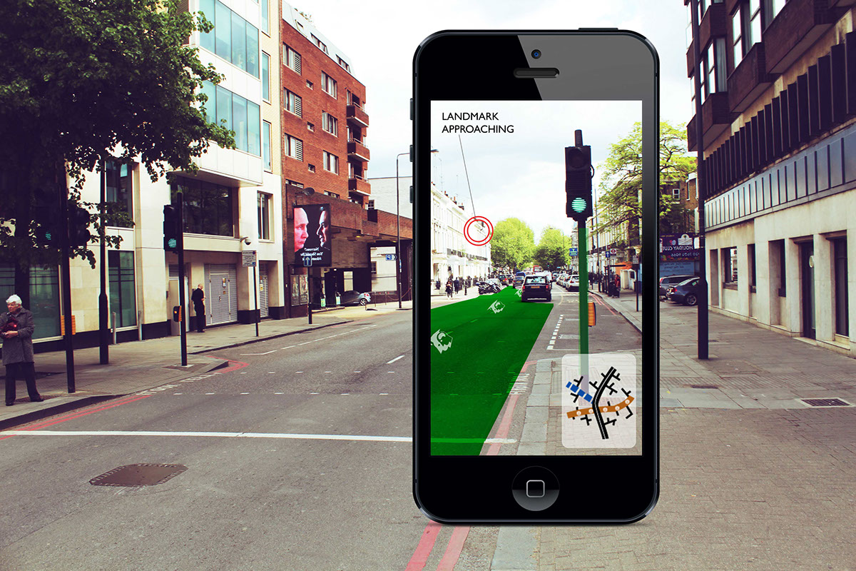
It gives VISUAL CUES built into an aerial view which enables AIMING and SCANNING - the colors and symbols on street signs double as landmarks, are non-language based. This system could also be very easily incorporated into an augmented reality system, where no physical changes would need to be made to street signage.
This design brings street signage into the future, and embraces our world shifting towards a more global community.
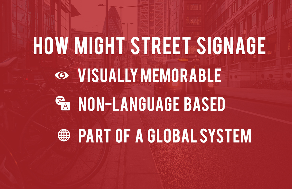
BRIEF: How might street signage be more VISUALLY MEMORABLE, NON-LANGUAGE BASED, PART OF A GLOBAL SYSTEM.
It gives VISUAL CUES built into an aerial view which enables AIMING and SCANNING - the colors and symbols on street signs double as landmarks, are non-language based. This system could also be very easily incorporated into an augmented reality system, where no physical changes would need to be made to street signage.
This design brings street signage into the future, and embraces our world shifting towards a more global community.
BRIEF: How might street signage be more VISUALLY MEMORABLE, NON-LANGUAGE BASED, PART OF A GLOBAL SYSTEM.

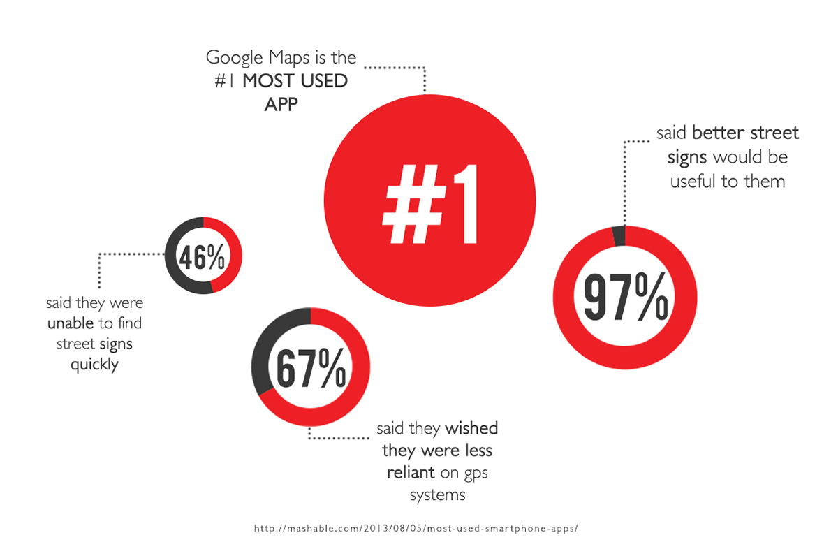
When navigating in a city there is constant looking up and down, phone-checking, because our dependency on GPS systems.

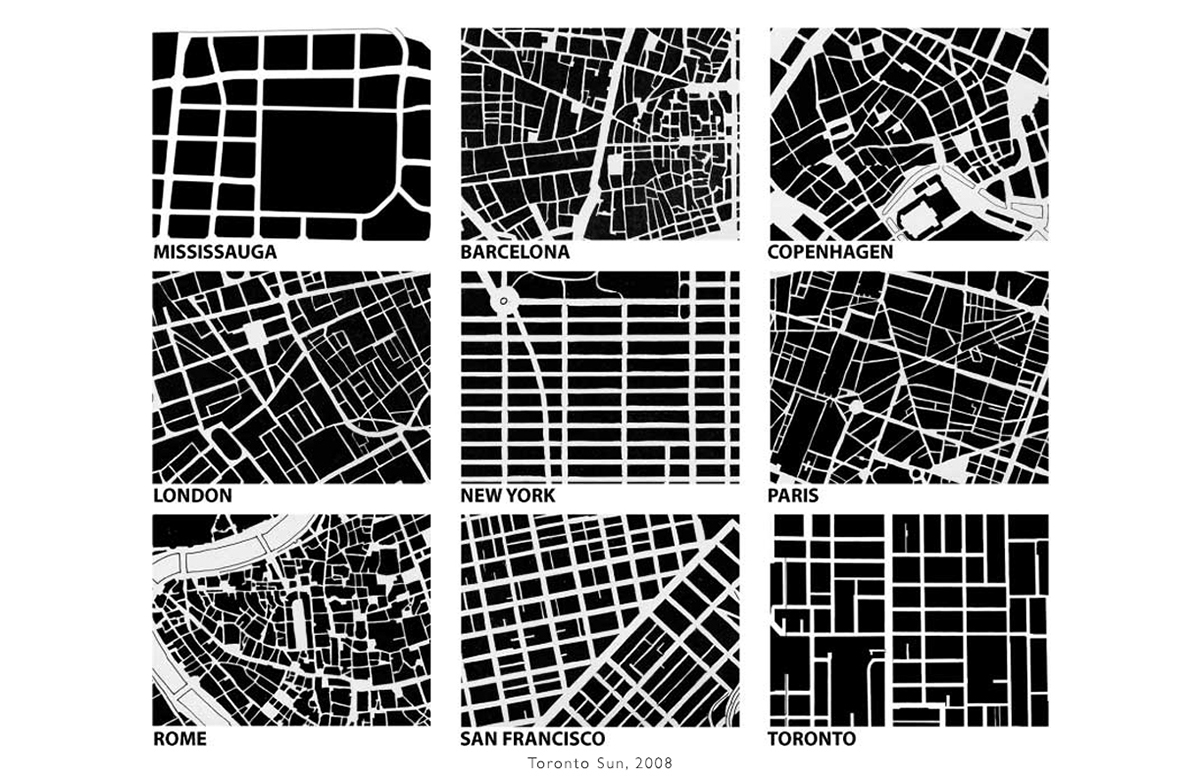
RESEARCH: Below is an image of street layout of different cities. They are all very different. Currently there is no public aid in quick comprehension of the organization of the streets and street hierarchies. Because of this variety It is very difficult, therefore, (on a global scale) for those who have never been to a city to begin to navigate.
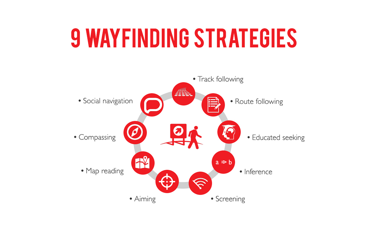
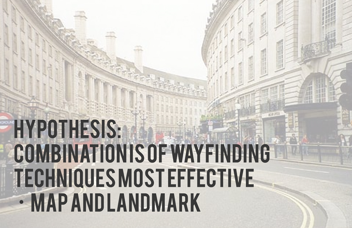
RESEARCH: These 9 wayfinding strategies are often used in combination when finding one's way. They are the natural strategies that humans use to attempt to navigate.
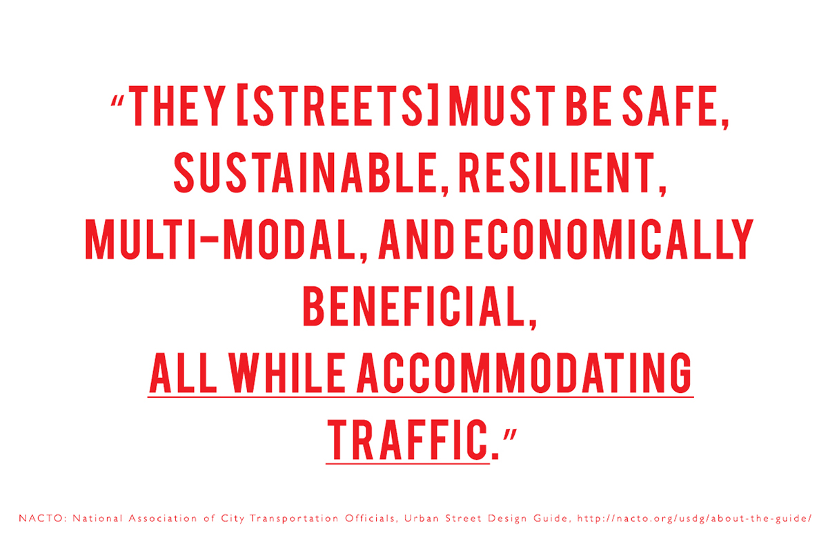
NEED: Currently street names, and sometimes street sign maps, are the only public navigation tools that exist on streets today. Why is this? Why have street signs not evolved or developed with the rest of our public spaces? With our tech? This is because there is NO FOCUS on navigation, foot traffic in streets - the focus is always on traffic and safety, which overlooks a need in our cities.
With the global community increasing, and the increase in the population of our cities, aids are needed to help people find their way in unfamiliar, pedestrian-friend urban centers. Being dependent on GPS systems weakens brain spacial memory. We need to take people off of their phones and ask them to look around.
With the global community increasing, and the increase in the population of our cities, aids are needed to help people find their way in unfamiliar, pedestrian-friend urban centers. Being dependent on GPS systems weakens brain spacial memory. We need to take people off of their phones and ask them to look around.


SOLUTION: Global signage system was developed - a color and symbol system for main streets. The system would work as a part of a global system, but symbols and colors would be culture-specific. Inspired by tube and subway maps, this signage would act as a supplement to any current street-name-signage system being used in the city.
It gives VISUAL CUES built into an aerial view, which enables AIMING and SCANNING.
It gives VISUAL CUES built into an aerial view, which enables AIMING and SCANNING.