We believe that modern navigation should be easier to use, more engaging and should actually improve one's spacial memory, as opposed to impairing it. Our team observed that modern GPS systems are not designed for short-distance, on-foot journeys. Navigating today is a passive process, often leaving the user without the ability to recall how they traveled to their destination.
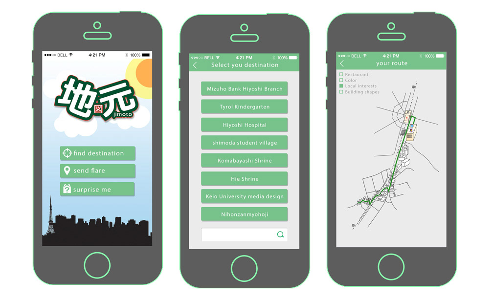
With the Jimoto map and system, we created a more natural mapping experience that you can access on our app or in a convenience store location. We combined both birds-eye view and street view, to give users visual cues as they use the map. We also simplified the map to include just the necessary landmarks so that users are not overwhelmed by too much information. Traditional GPS systems can weaken one's special memory because they do not engage the user. With the use of Jimoto, people will find navigating their cities more engaging, more memorable and more enjoyable, all while developing their spacial memory.

** Won 2015 CORE77 DESIGN AWARDS: Service Design Student Notable **

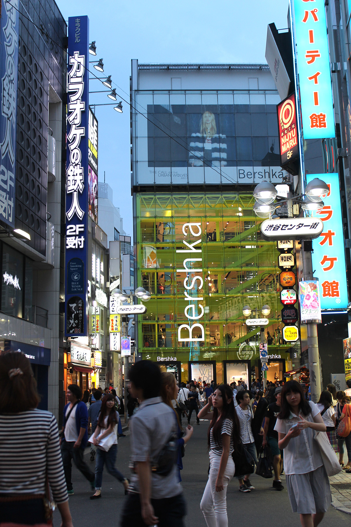
Even with modern GPS systems, the streets of Tokyo, Japan can lead in unpredictable directions. With few street signs and winding streets, landmarks and signage are really the answer. They can help you to look up and around you instead of into your phone, and can help you remember where you've been and where you're going.
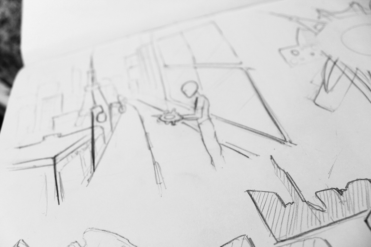
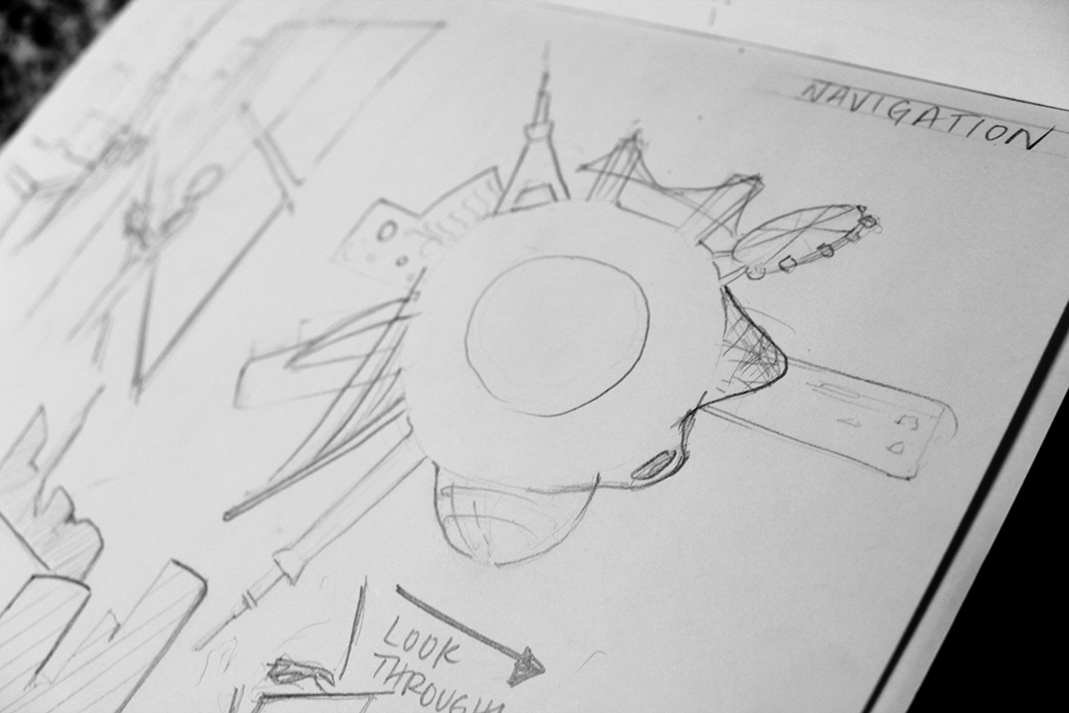
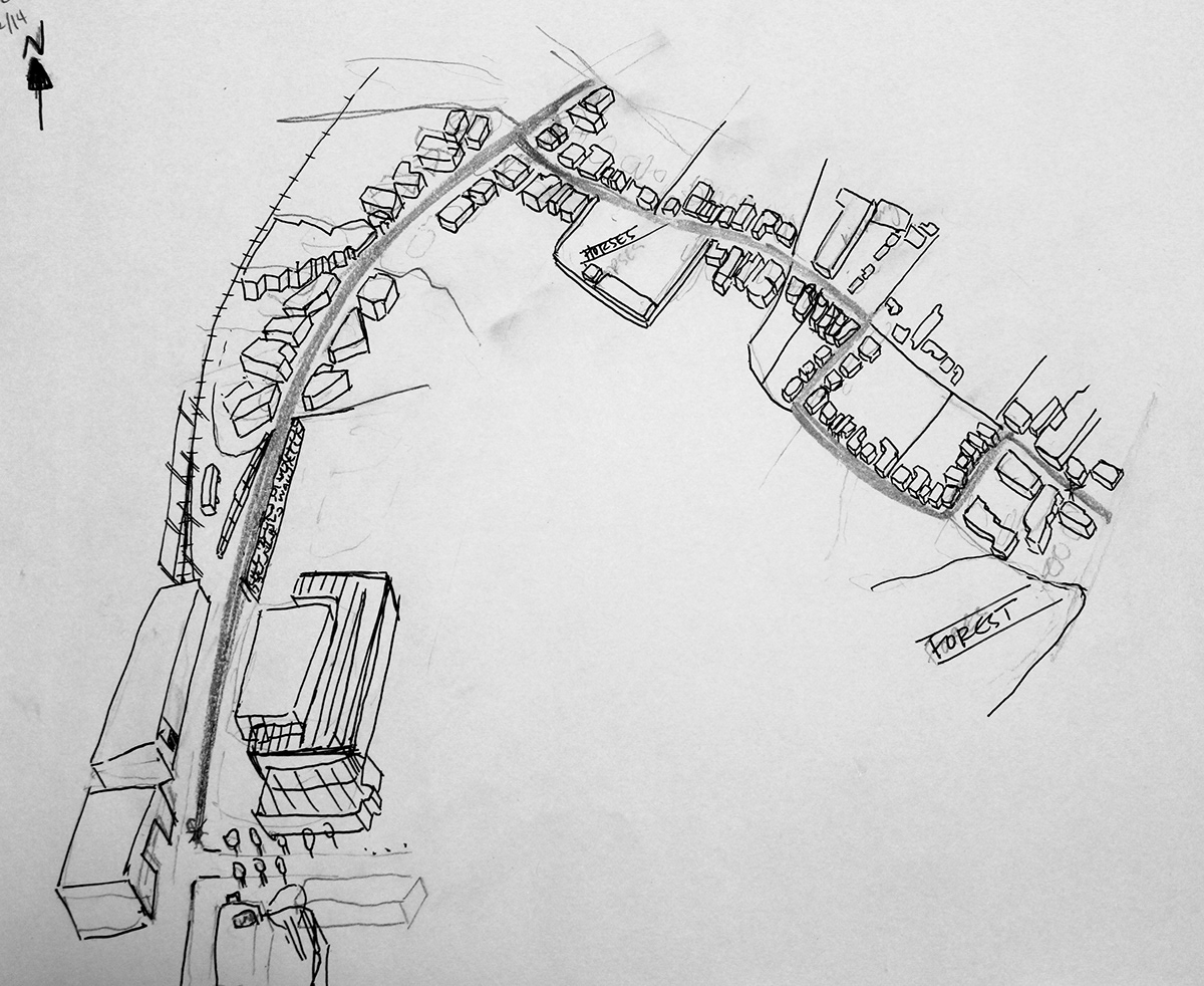
Ideation Sketches
Hand-drawn 3D/birds-eye view prototype of map re-design for navigation system.
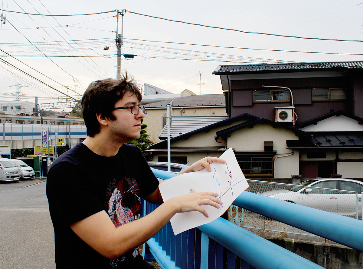
Field work and testing for hand drawn map.
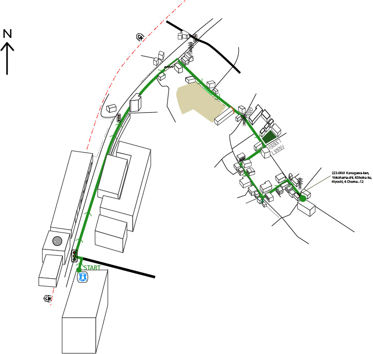
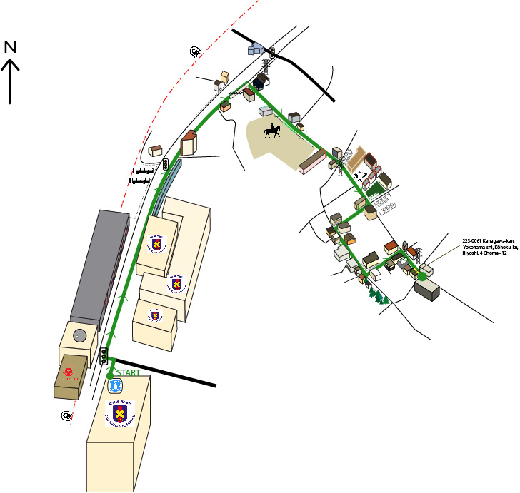
Customization option - bare minimum information. Structures shown at turning points, relevant streets shown.
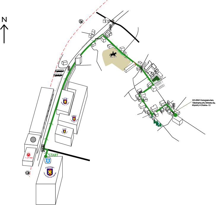
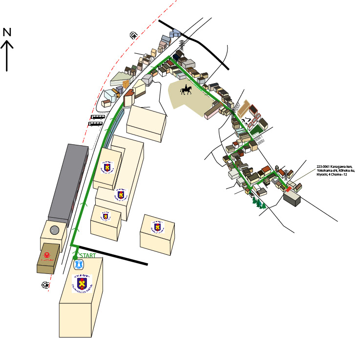
Customization option - logos of major local business. Structures shown at turning points, relevant streets shown, logos shown.
Customization option - colors of structures shown. Structures shown at turning points, relevant streets shown, logos shown, colors of building shown.
Customization option - all. Structures shown at turning points, relevant streets shown, logos shown, colors of building shown, and all surrounding building shown.
Convenience store application.
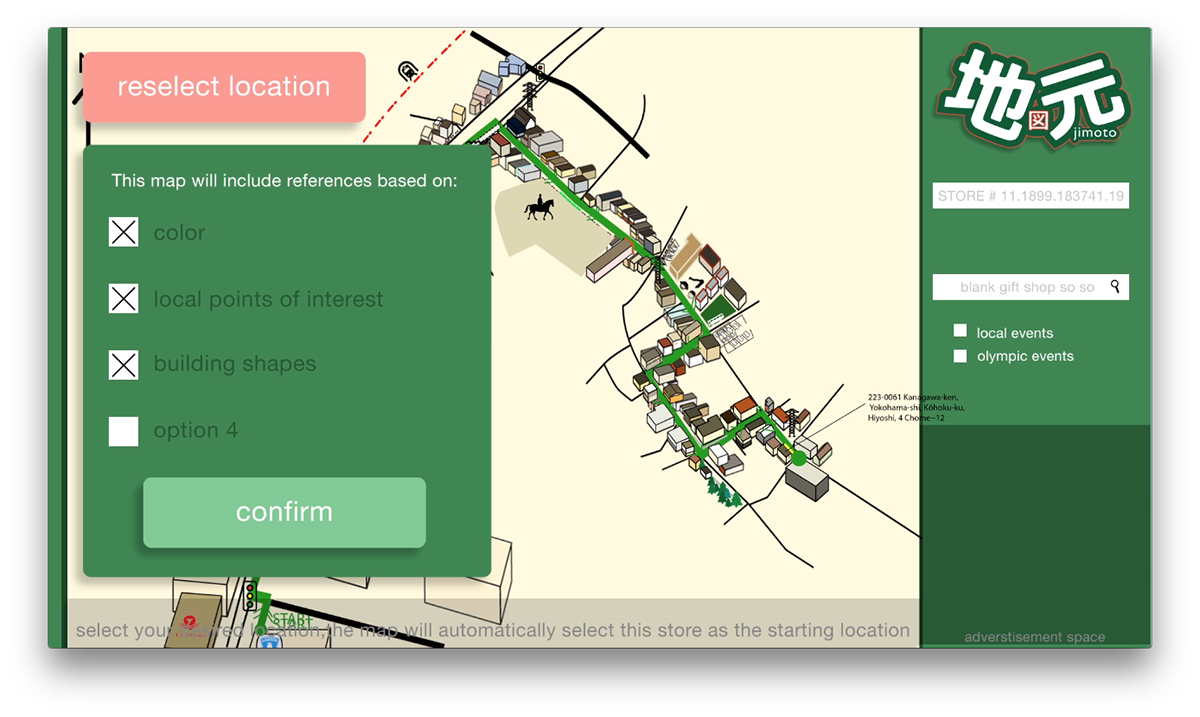
Shows possible customization options of 2D/birds-eye-view map, created by designers and locals.
Shows possible customization options of 2D/birds-eye-view map, created by designers and locals.
iPhone Application.
Shows customization options of 2D/birds-eye-view map, created by designers and locals.
Shows customization options of 2D/birds-eye-view map, created by designers and locals.
Project was created by Francesca Veres, Mo Wang and Dayna Mailach as a part of the Global Innovation Design program, a joint program between the Pratt Institute's (New York, USA) Masters of Industrial Design, Keio University's (Tokyo, Japan) Keio Media Design and Royal College of Art/Imperial College's (London, England) Innovation Design Engineering.