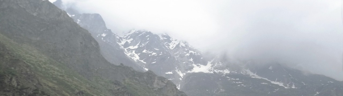
In the summer of 2013, the Himalayas witnessed one of their worst disasters, a cloudburst that burst the Chorabariglacier, causing flash floods and landslides across the Himalayan state of Uttarakhand in India. The state of Uttarakhand was in peak pilgrimage and tourist period, and the disaster had led to over 5000 casualities.
Armed forces and varous organisationd pitched in to aid the rescue and relief process, but was complicated by the fragile Himalayan landscape, where people were stranded, helicopters couldnt land, and there was danger of ore to come.
I myself had visited the state shortly before the disaster, and as a student of Space design, I wanted to be able to address the needs of a situaton like this. What followed was a conceptual project attempting at addressing these needs.
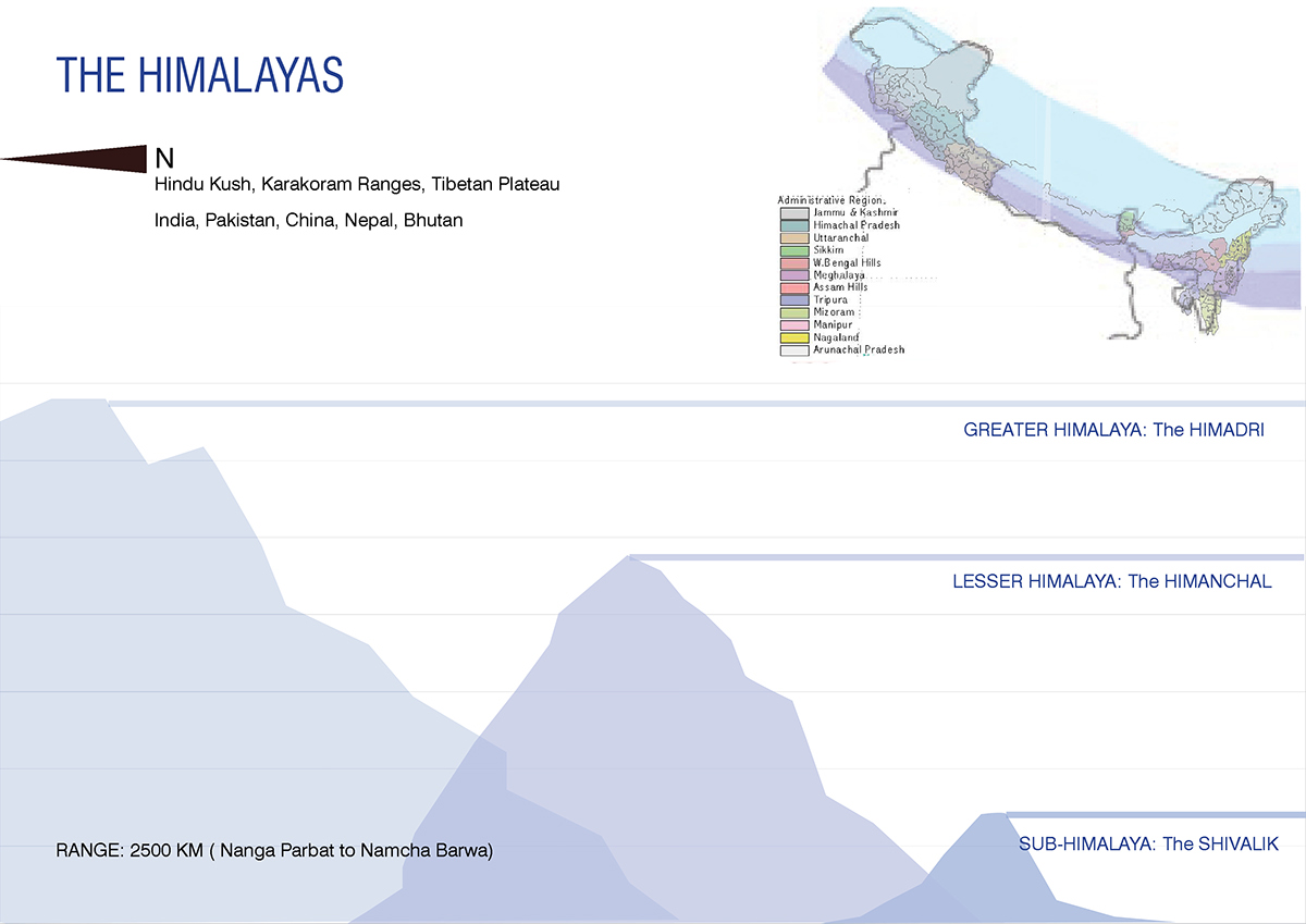
The Himalayas in India stretch over a vast geographical and cultural belt. To make work simpler, I narrowed context to a state that I had already visited: Uttarakhand.
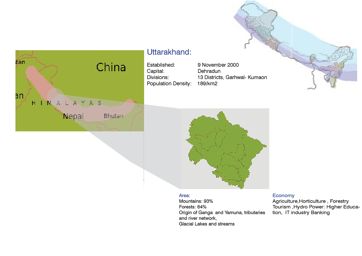
The state of Uttarakhand has large areas under protected forest cover, as well as a fragile landcape, making industries such as Tourism, one of the primary sources of economy in the state. They try to harness a mix of religious, cultural, vacation and adventure tourism to be able to attract tourists from all over the country, and internationally as well.
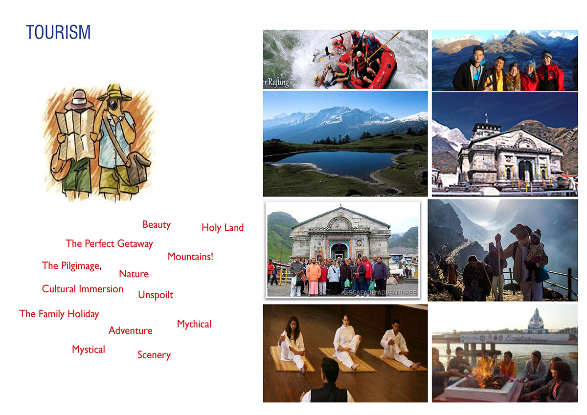
Tourists are generally unfamiliar with the Himalayan landscape, and are therefore vulnerable.
In order to address this, the many disasters possible in the Himalayas, in the context of Uttarakhand and the risk factors were looked at. Three major disasters were selected to consider as factors for design; earthquakes, landslides and floods.
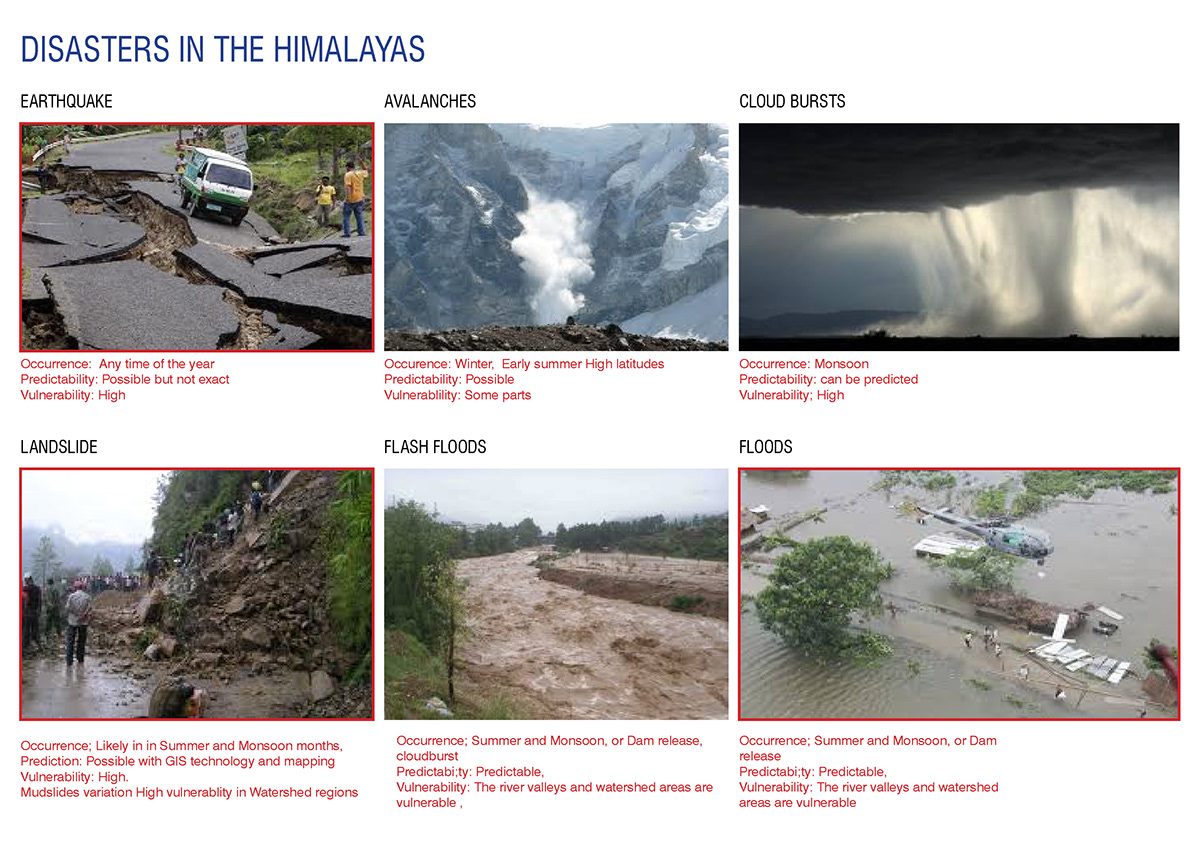
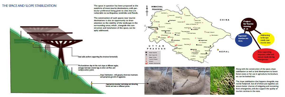
The occurrences of these hazards were mapped, to seek places where multiple hazards overlapped, and identify vulnerable locations on the tourism circuitswhere interventon would be needed.

The occurrence of a disaster, and how communities generally cope with them , was analysed in the form of a systems' model. While most mitigation practices address affected communities, the manner in which floating populations, in this case, tourists would be affected.

While prevention based mitigation suits communities, floating populations have no way of being a part of these preventive tactics. In their case, response, rescue and relief need to be made more efficient and capable.
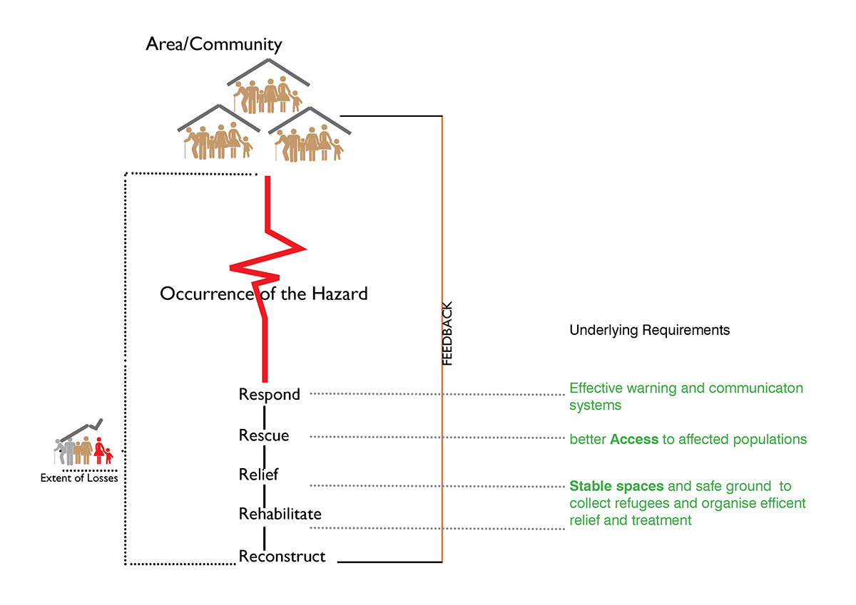
Given that tourism is one of Uttarakhand's main sources of economy, I sought to find a method of addressing the relief need, and also turn it into an opportunity for tourism to flourish. A stable , safe space where relief operations can be carried out and victims brought to safety is a constant need during rescue and relief operations. This is difficult to achieve on a vulnerable natural landscape in the Himalayas. However , if such a space were to be created artificialy, engineered to withstand and stay stable during times of emergency, it may aid the disaster management process better.
One reason why tourists come to the Himalayas is , in spite of the long road based travel, the view of the landscape is a constant memorable attraction. Even while journeying in a cramped vehicle, one would want to enjoy the landscape with an occasional pause in the journey.
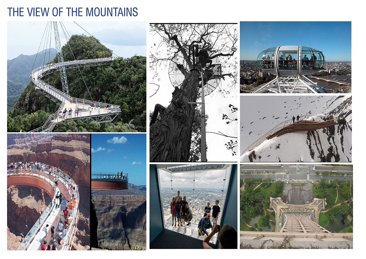
Spaces that provided a beautiful view are not new, and I looked at a few examples of places worldwide where such spaces were built.
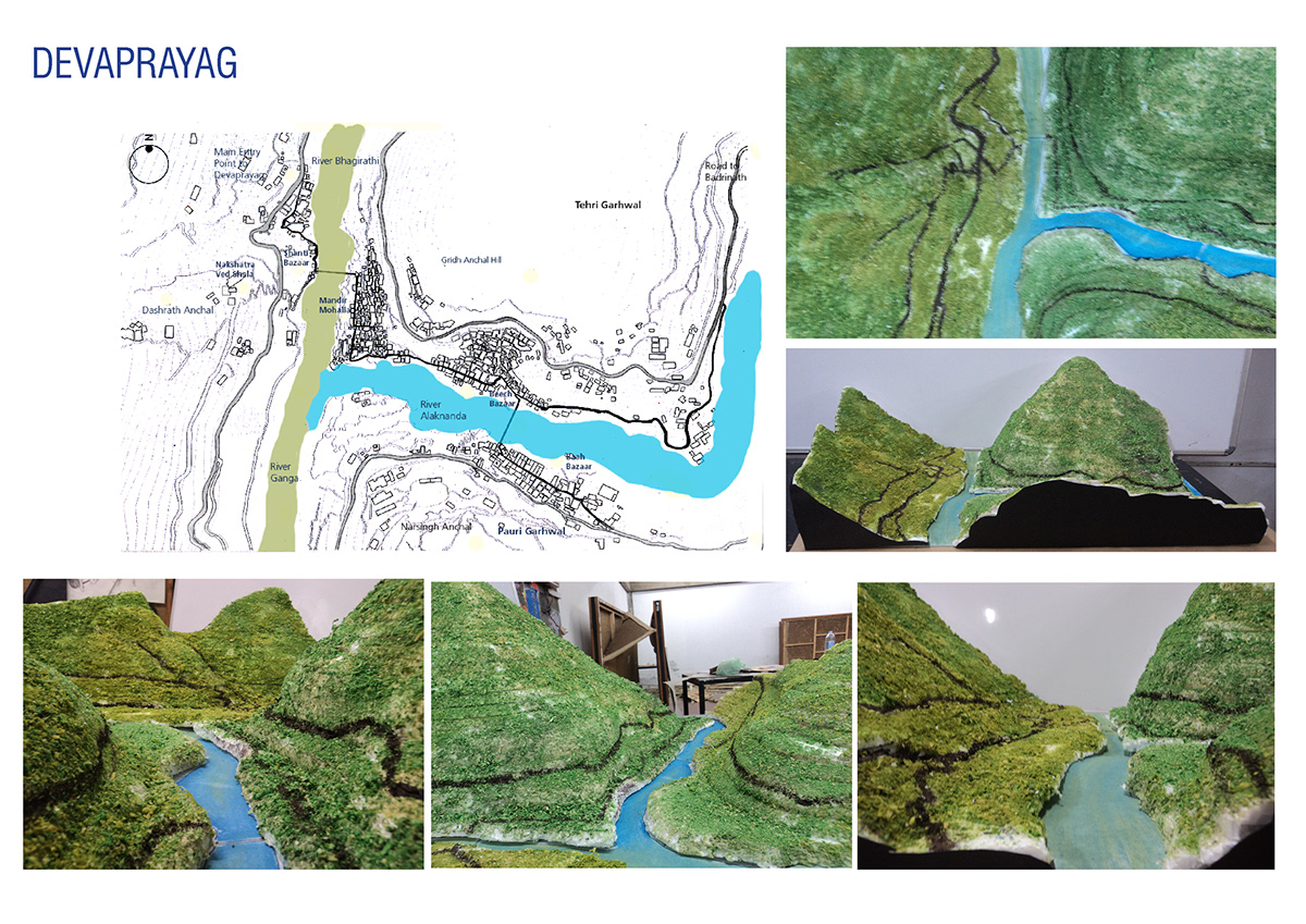
To narrow down, I took the context of a town called Devaprayag in Uttarakhand, which, apart from being a plgrimage centre, is the site of confluence of the Alaknanda and the Bhagirathi, beginning the river Ganga. Using geographical data, its landscape was modelled and used as reference to develop a design.
To be able to access a viewing space while journeying, it would have to be close to the roads, which would also make it easier to access in emergencies.A space that could protrude over the road, as a 'shade' of sorts, interested me. A sculptural approach would draw people to the space.
Adjacencies were plotted, to see how services could be handed. The idea of a spatial balcony where people stand at the railings , and enjoy a quiet cup of coffee, while looking at the landsape, maybe even a cafe could be incorporated?
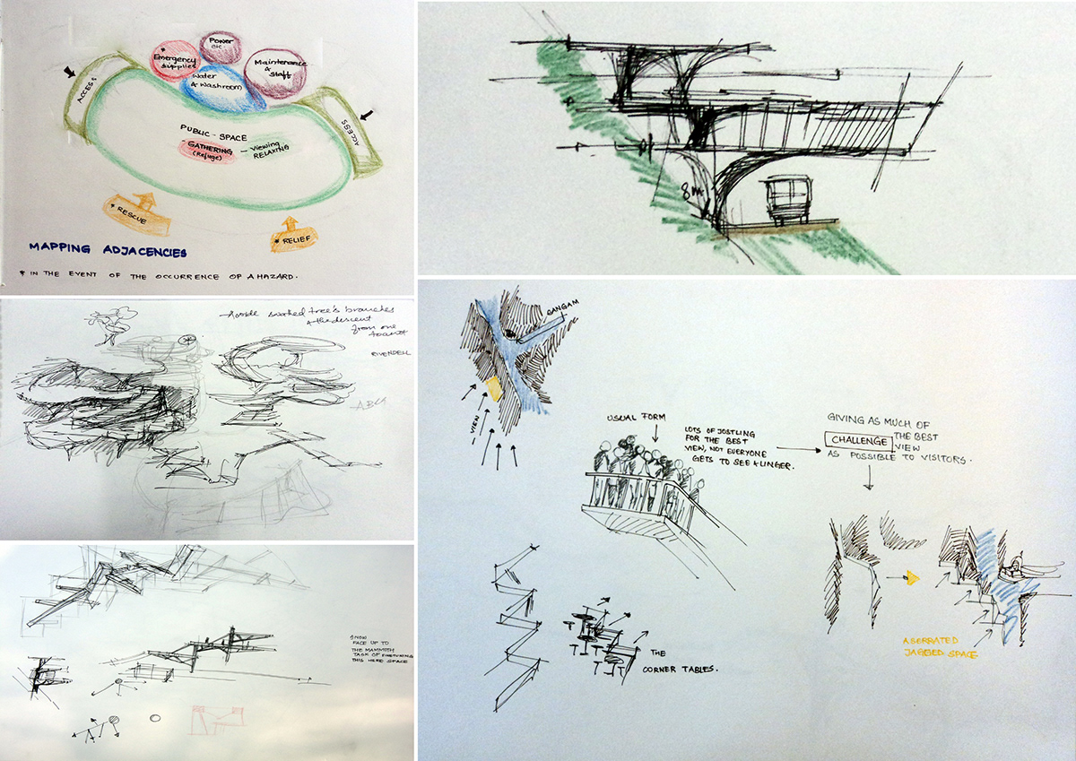
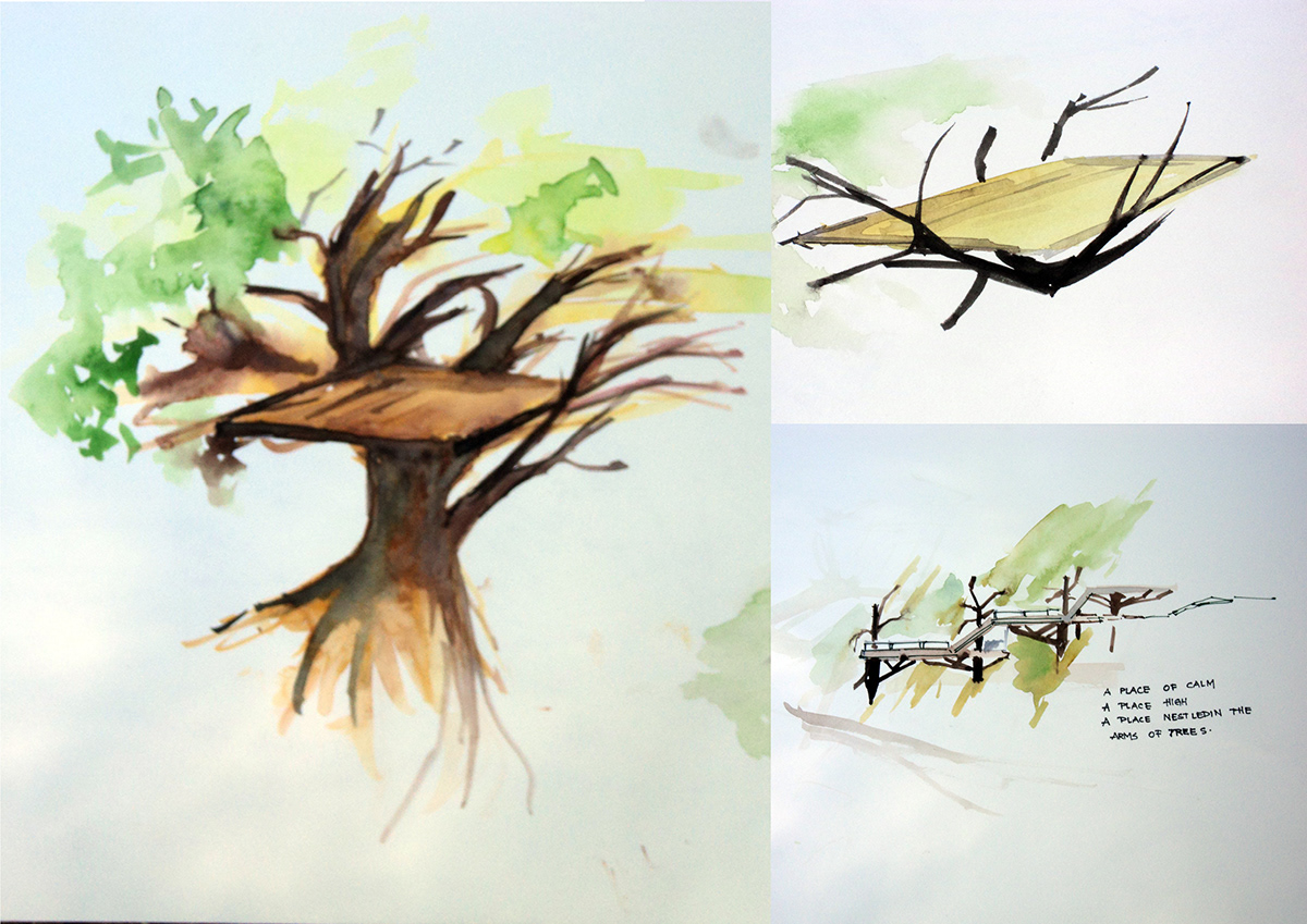
The idea of a machan in a tree, a viewing paltform used traditionally in india, inspired me as a possible concept. Branches that hold the platfom in place, and an uninterrupted view.
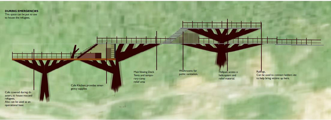
The space was envisioned as a publc space where one could take a stroll, and enjoy some coffee, while during emergencies, it could double as a helipad, or set up camp and access relief.
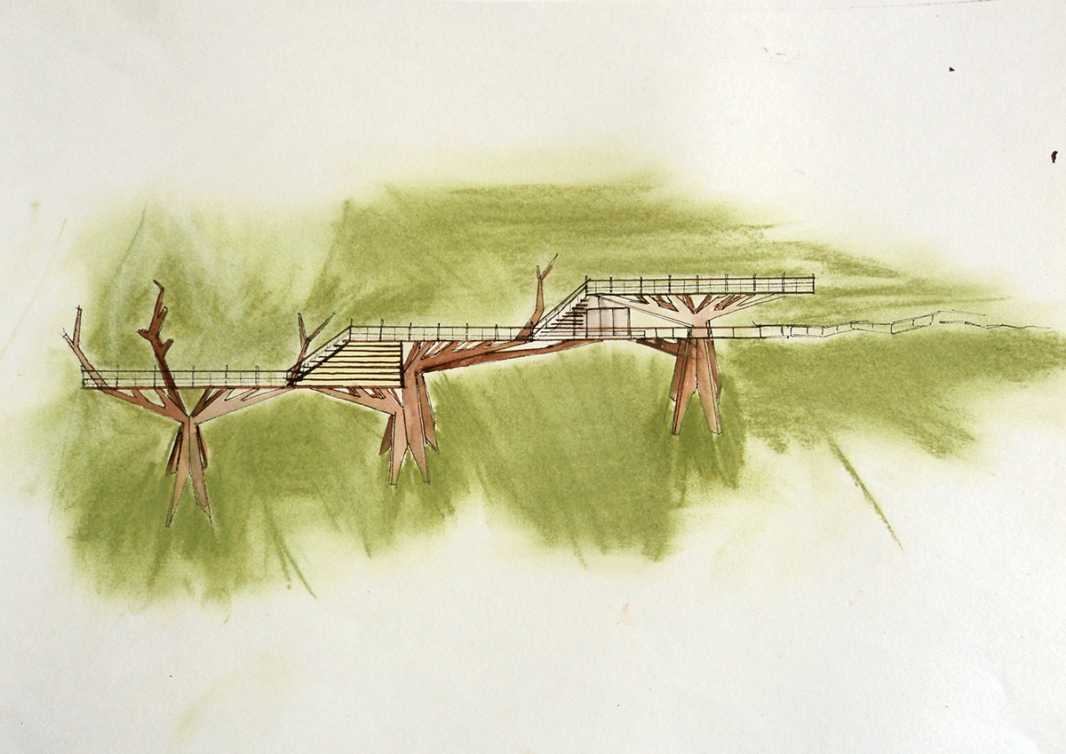
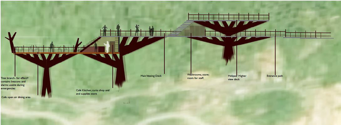
One of the initial sketches, of a space in three levels, where a mountain path opens onto the middle platform. The platform below houses a cafe kitchen and open air dining, while the uppermost platform is a helipad, also the highest vantage point. Services like washrooms were incorporated, and the space was envisioned as sculptural, but not stark on the landscape.
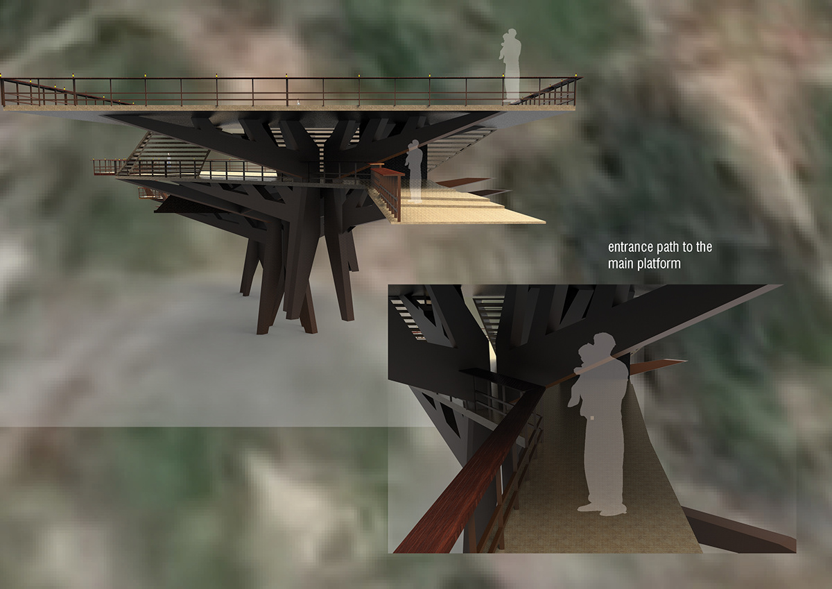
The supports would be shaped like abstracted tree sections, with gaps to allow debristo flow past without affecting the structure.
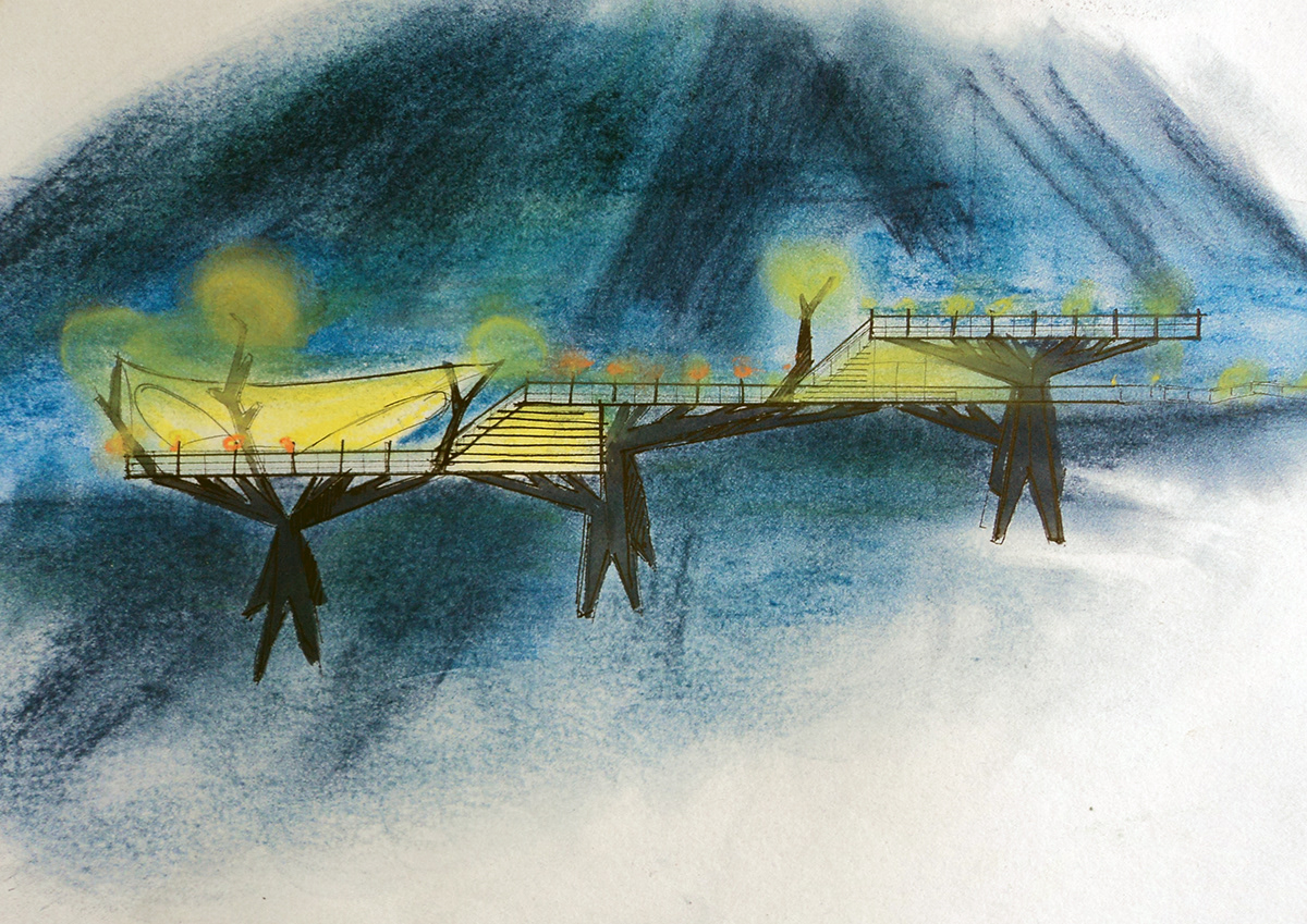
A night view, where the space could be lit, to be visible across the landscape,and also have a canopy that could be put up when needed. The space would be made of structural steel, so it sits lighter on the landscape.
Renders of the space were created, with the idea of a multi tiered, balcony-ish approach in mind.
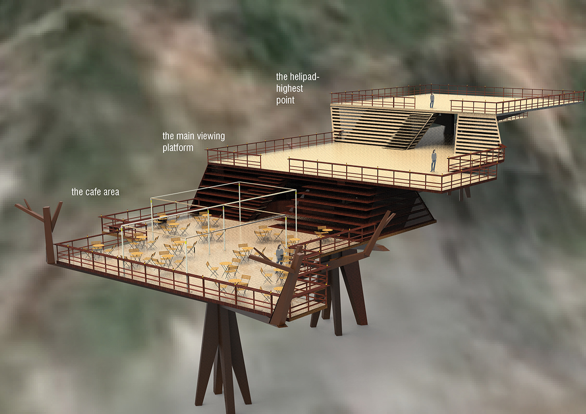
The entrance starts above the road, as a mountain path that ducks below the branch supports to emerge onto the middle platform.
The middle platform and the Helipad.

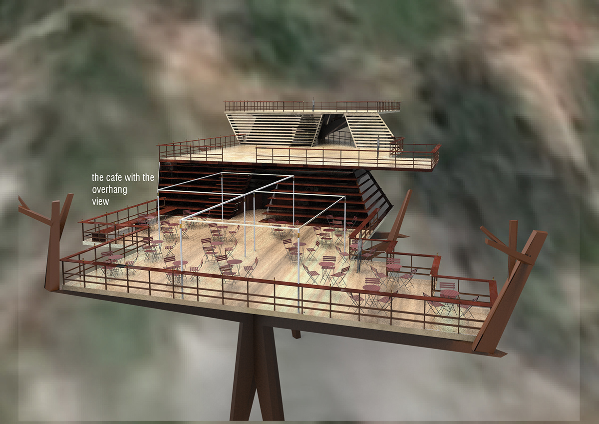
The cafe and restaurant. A serrated balcony , where each corner has a table, to maxmise view opportunity. A framework is provided to support a roll out canopy when needed
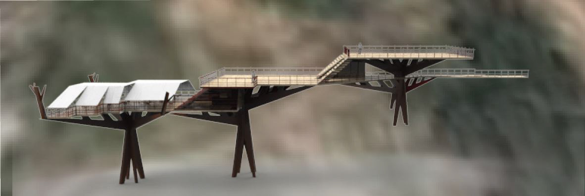
Elevation view with canopy.
Usage of space schematic during normal times
Usage of space schematic during emergencies
The space would be anchored onto the slope using pile foundations . This space could be constructed close to major tourist destinations as a facility, and act as a space where the army may carryoutt relief operations during emergences. Also, the construction of such spaces may draw attention to the slopes of the sites, and aid int heir stabilization.
This project was a conceptual attempt on my part to address Disaster mitigation and management in mountains. In real life, such an undertaking would require the heavy expertise fo architects, engineers and geography specialists. There do exist engineering firms that specialize in bringing challenging tructures to life. I sincerely hope that attempts are made to address disaster management needs in challenging locations.

