

The Illuminated Shores: Mapping every lighthouse in the world illuminating our shores & visualizing the light characteristics of the 30 tallest lighthouses
Lighthouses are towers or structures designed to aid mariner navigation at sea or at inland waterways. They mark the most dangerous coasts and emit light in uniquely identifiable patterns in the night. During the day, they can be identified by patterns on their outer walls (most commonly stripes).
The majority of the world’s lighthouses are located in the Northern Hemisphere, with the most in Europe. However, the country with the most lighthouses is Japan, with 2,583 lighthouses. Also identified on the map are the top 5 countries with the most lighthouses: 1) Japan; 2) Canada; 3) USA; 4) France; 5) Sweden.
Located on the Red Sea in Jeddah, Saudi Arabia is Jeddah Light, the world’s tallest lighthouse. The Lesnoy Mole Range Lights in Saint Petersburg, Russia are the world’s tallest range lights—a pair of lights designed to indicate distances between two points, often situated at inland waterways.

How It Works
Every lighthouse in the world is mapped by relative geographical location, demonstrating how almost all of the world’s coastlines are illuminated by these manmade structures.

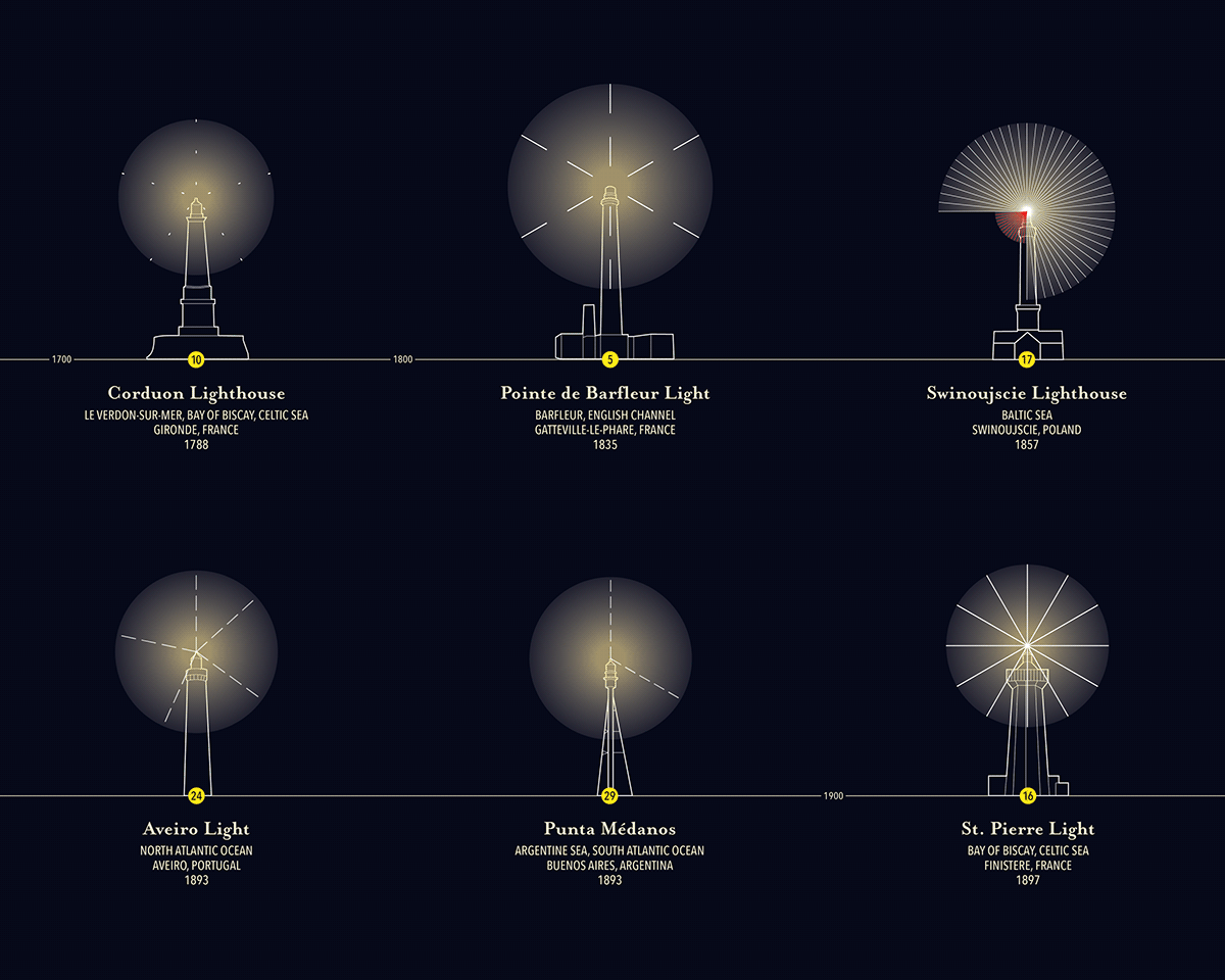
The 30 tallest lighthouses in the world are organized in chronological order on a collapsed timeline. Silhouettes of each lighthouse are drawn to scale, with circles that visualize their range (in nautical miles). These circles form pie charts: where 360 degrees represents 60 seconds. The unique light characteristics (color and flash patterns) are visualized using stylized lines. For example: 3 white lines each with 2 dashes represent a white light that flashes twice every 20 seconds.

Designed by Kanny Yeung


